You are here: Home > Network List > IU - Global Seismograph Network (GSN - IRIS/USGS) Stations List
> Station SLBS Sierra la Laguna Baja California Sur, Mexico > Earthquake Result Viewer
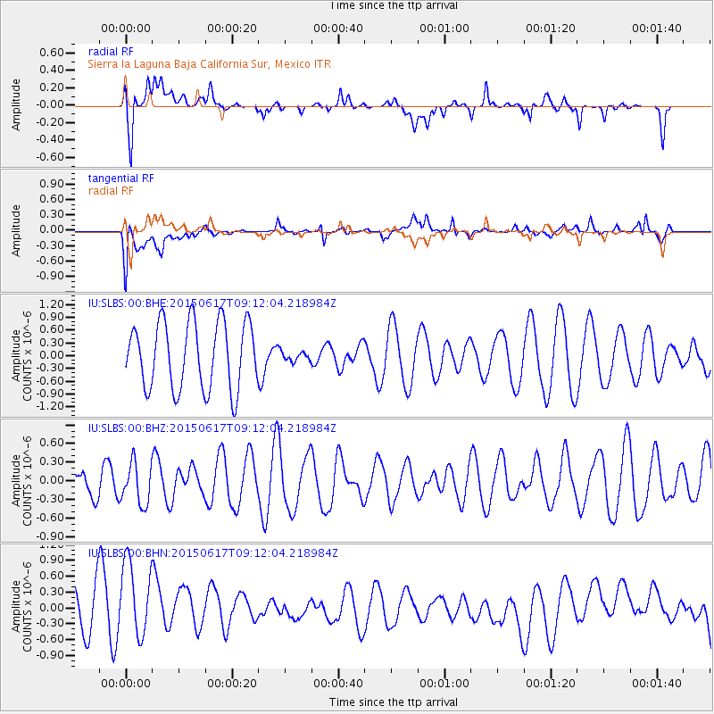
SLBS Sierra la Laguna Baja California Sur, Mexico - Earthquake Result Viewer
*The percent match for this event was below the threshold and hence no stack was calculated.
| Earthquake location: |
South Of Kermadec Islands |
| Earthquake latitude/longitude: |
-32.4/179.5 |
| Earthquake time(UTC): |
2015/06/17 (168) 09:00:29 GMT |
| Earthquake Depth: |
372 km |
| Earthquake Magnitude: |
4.6 mb |
| Earthquake Catalog/Contributor: |
ISC/ISC |
|
| Network: |
IU Global Seismograph Network (GSN - IRIS/USGS) |
| Station: |
SLBS Sierra la Laguna Baja California Sur, Mexico |
| Lat/Lon: |
23.69 N/109.94 W |
| Elevation: |
825 m |
|
| Distance: |
87.4 deg |
| Az: |
59.907 deg |
| Baz: |
232.998 deg |
| Ray Param: |
$rayparam |
*The percent match for this event was below the threshold and hence was not used in the summary stack. |
|
| Radial Match: |
46.98276 % |
| Radial Bump: |
400 |
| Transverse Match: |
51.69667 % |
| Transverse Bump: |
400 |
| SOD ConfigId: |
7422571 |
| Insert Time: |
2019-04-19 09:08:09.519 +0000 |
| GWidth: |
2.5 |
| Max Bumps: |
400 |
| Tol: |
0.001 |
|
Signal To Noise
| Channel | StoN | STA | LTA |
| IU:SLBS:00:BHZ:20150617T09:12:04.218984Z | 0.71033114 | 3.2848936E-7 | 4.6244537E-7 |
| IU:SLBS:00:BHN:20150617T09:12:04.218984Z | 1.4763815 | 9.787582E-7 | 6.6294393E-7 |
| IU:SLBS:00:BHE:20150617T09:12:04.218984Z | 0.13959038 | 1.0913136E-7 | 7.8179716E-7 |
| Arrivals |
| Ps | |
| PpPs | |
| PsPs/PpSs | |


