MA2 Magadan, Russia - Earthquake Result Viewer
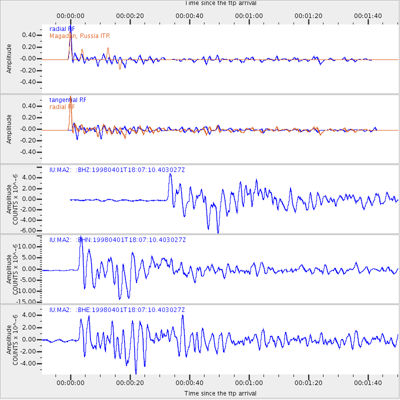
Earthquake location: Southern Sumatra, Indonesia
Earthquake latitude/longitude: -0.5/99.3
Earthquake time(UTC): 1998/04/01 (091) 17:56:23 GMT
Earthquake Depth: 56 km
Earthquake Magnitude: 6.2 MB, 6.9 MS, 7.0 UNKNOWN, 6.6 ME
Earthquake Catalog/Contributor: WHDF/NEIC
Network: IU Global Seismograph Network (GSN - IRIS/USGS)
Station: MA2 Magadan, Russia
Lat/Lon: 59.58 N/150.77 E
Elevation: 339 m
Distance: 72.0 deg
Az: 24.758 deg
Baz: 235.37 deg
Ray Param: 0.053821344
Estimated Moho Depth: 36.25 km
Estimated Crust Vp/Vs: 1.60
Assumed Crust Vp: 6.134 km/s
Estimated Crust Vs: 3.834 km/s
Estimated Crust Poisson's Ratio: 0.18
Radial Match: 97.98084 %
Radial Bump: 400
Transverse Match: 95.93792 %
Transverse Bump: 400
SOD ConfigId: 4480
Insert Time: 2010-03-03 14:47:26.802 +0000
GWidth: 2.5
Max Bumps: 400
Tol: 0.001

Signal To Noise

ChannelStoNSTALTA
IU:MA2: :BHN:19980401T18:07:10.403027Z43.7388235.9800523E-61.3672184E-7
IU:MA2: :BHE:19980401T18:07:10.403027Z16.0409871.4337166E-68.937833E-8
IU:MA2: :BHZ:19980401T18:07:10.403027Z21.3832191.9662289E-69.195196E-8
Arrivals
Ps3.7 SECOND
PpPs15 SECOND
PsPs/PpSs19 SECOND