MA2 Magadan, Russia - Earthquake Result Viewer
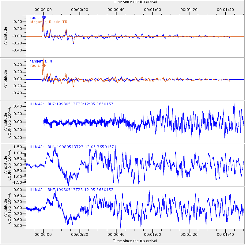
Earthquake location: New Britain Region, P.N.G.
Earthquake latitude/longitude: -5.1/151.7
Earthquake time(UTC): 1998/05/13 (133) 23:02:05 GMT
Earthquake Depth: 61 km
Earthquake Magnitude: 6.0 MB, 6.6 UNKNOWN, 5.9 ME
Earthquake Catalog/Contributor: WHDF/NEIC
Network: IU Global Seismograph Network (GSN - IRIS/USGS)
Station: MA2 Magadan, Russia
Lat/Lon: 59.58 N/150.77 E
Elevation: 339 m
Distance: 64.5 deg
Az: 359.468 deg
Baz: 178.958 deg
Ray Param: 0.058728106
Estimated Moho Depth: 28.25 km
Estimated Crust Vp/Vs: 1.85
Assumed Crust Vp: 6.134 km/s
Estimated Crust Vs: 3.32 km/s
Estimated Crust Poisson's Ratio: 0.29
Radial Match: 96.44483 %
Radial Bump: 396
Transverse Match: 83.83581 %
Transverse Bump: 400
SOD ConfigId: 4480
Insert Time: 2010-03-03 14:47:34.678 +0000
GWidth: 2.5
Max Bumps: 400
Tol: 0.001

Signal To Noise

ChannelStoNSTALTA
IU:MA2: :BHN:19980513T23:12:05.365015Z5.9362675.627084E-79.479163E-8
IU:MA2: :BHE:19980513T23:12:05.365015Z3.69187282.6729566E-77.240111E-8
IU:MA2: :BHZ:19980513T23:12:05.365015Z1.17583365.3196736E-84.5241723E-8
Arrivals
Ps4.0 SECOND
PpPs13 SECOND
PsPs/PpSs17 SECOND