MA2 Magadan, Russia - Earthquake Result Viewer
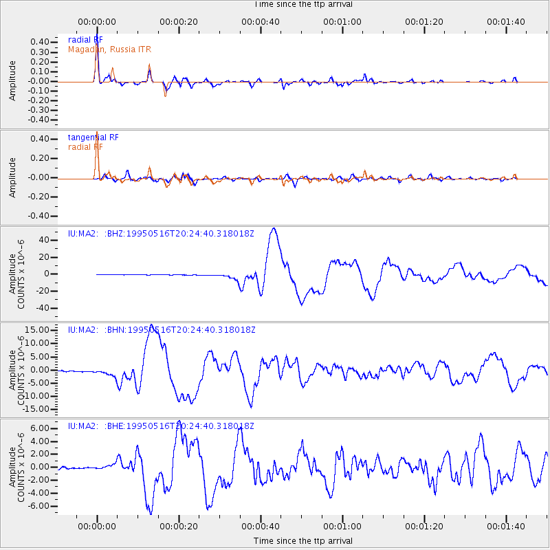
Earthquake location: Southeast Of Loyalty Islands
Earthquake latitude/longitude: -23.0/169.9
Earthquake time(UTC): 1995/05/16 (136) 20:12:45 GMT
Earthquake Depth: 33 km
Earthquake Magnitude: 6.8 MB, 7.7 MS, 7.7 UNKNOWN, 7.7 MW
Earthquake Catalog/Contributor: WHDF/NEIC
Network: IU Global Seismograph Network (GSN - IRIS/USGS)
Station: MA2 Magadan, Russia
Lat/Lon: 59.58 N/150.77 E
Elevation: 339 m
Distance: 83.8 deg
Az: 350.345 deg
Baz: 162.325 deg
Ray Param: 0.04590283
Estimated Moho Depth: 28.0 km
Estimated Crust Vp/Vs: 1.91
Assumed Crust Vp: 6.134 km/s
Estimated Crust Vs: 3.211 km/s
Estimated Crust Poisson's Ratio: 0.31
Radial Match: 97.935 %
Radial Bump: 326
Transverse Match: 92.921585 %
Transverse Bump: 400
SOD ConfigId: 6273
Insert Time: 2010-03-03 14:49:23.665 +0000
GWidth: 2.5
Max Bumps: 400
Tol: 0.001

Signal To Noise

ChannelStoNSTALTA
IU:MA2: :BHN:19950516T20:24:40.318018Z13.0907751.4540572E-61.11074954E-7
IU:MA2: :BHE:19950516T20:24:40.318018Z4.84267434.6234942E-79.547398E-8
IU:MA2: :BHZ:19950516T20:24:40.318018Z35.2700084.327956E-61.2270925E-7
Arrivals
Ps4.2 SECOND
PpPs13 SECOND
PsPs/PpSs17 SECOND