MA2 Magadan, Russia - Earthquake Result Viewer
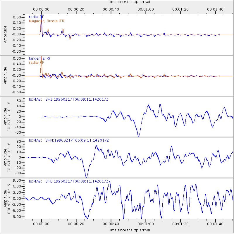
Earthquake location: Irian Jaya Region, Indonesia
Earthquake latitude/longitude: -0.9/137.0
Earthquake time(UTC): 1996/02/17 (048) 05:59:29 GMT
Earthquake Depth: 33 km
Earthquake Magnitude: 6.5 MB, 8.1 MS, 7.9 UNKNOWN
Earthquake Catalog/Contributor: WHDF/NEIC
Network: IU Global Seismograph Network (GSN - IRIS/USGS)
Station: MA2 Magadan, Russia
Lat/Lon: 59.58 N/150.77 E
Elevation: 339 m
Distance: 61.3 deg
Az: 7.922 deg
Baz: 195.711 deg
Ray Param: 0.06090233
Estimated Moho Depth: 14.75 km
Estimated Crust Vp/Vs: 2.10
Assumed Crust Vp: 6.134 km/s
Estimated Crust Vs: 2.924 km/s
Estimated Crust Poisson's Ratio: 0.35
Radial Match: 98.403725 %
Radial Bump: 258
Transverse Match: 90.440216 %
Transverse Bump: 400
SOD ConfigId: 6273
Insert Time: 2010-03-03 14:50:29.071 +0000
GWidth: 2.5
Max Bumps: 400
Tol: 0.001

Signal To Noise

ChannelStoNSTALTA
IU:MA2: :BHN:19960217T06:09:11.142017Z2.92180421.1686709E-63.999826E-7
IU:MA2: :BHE:19960217T06:09:11.142017Z1.36912184.7214087E-73.4484944E-7
IU:MA2: :BHZ:19960217T06:09:11.142017Z4.06168372.6634546E-66.5575136E-7
Arrivals
Ps2.7 SECOND
PpPs7.2 SECOND
PsPs/PpSs9.9 SECOND