You are here: Home > Network List > CN - Canadian National Seismograph Network Stations List
> Station INK INUVIK, NT > Earthquake Result Viewer
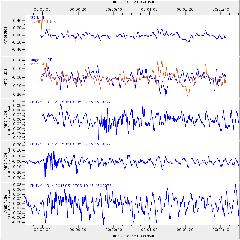
INK INUVIK, NT - Earthquake Result Viewer
*The percent match for this event was below the threshold and hence no stack was calculated.
| Earthquake location: |
Bonin Islands, Japan Region |
| Earthquake latitude/longitude: |
27.0/143.8 |
| Earthquake time(UTC): |
2015/06/19 (170) 08:09:54 GMT |
| Earthquake Depth: |
19 km |
| Earthquake Magnitude: |
4.9 MW |
| Earthquake Catalog/Contributor: |
ISC/ISC |
|
| Network: |
CN Canadian National Seismograph Network |
| Station: |
INK INUVIK, NT |
| Lat/Lon: |
68.31 N/133.53 W |
| Elevation: |
44 m |
|
| Distance: |
62.5 deg |
| Az: |
24.566 deg |
| Baz: |
274.058 deg |
| Ray Param: |
$rayparam |
*The percent match for this event was below the threshold and hence was not used in the summary stack. |
|
| Radial Match: |
39.39056 % |
| Radial Bump: |
400 |
| Transverse Match: |
57.20787 % |
| Transverse Bump: |
400 |
| SOD ConfigId: |
7422571 |
| Insert Time: |
2019-04-19 09:31:09.016 +0000 |
| GWidth: |
2.5 |
| Max Bumps: |
400 |
| Tol: |
0.001 |
|
Signal To Noise
| Channel | StoN | STA | LTA |
| CN:INK: :BHZ:20150619T08:19:45.450027Z | 2.225003 | 1.050675E-7 | 4.7221285E-8 |
| CN:INK: :BHN:20150619T08:19:45.450027Z | 0.95522296 | 3.256281E-8 | 3.4089222E-8 |
| CN:INK: :BHE:20150619T08:19:45.450027Z | 1.449494 | 4.5534048E-8 | 3.1413755E-8 |
| Arrivals |
| Ps | |
| PpPs | |
| PsPs/PpSs | |


