You are here: Home > Network List > GS - US Geological Survey Networks Stations List
> Station KAN13 Rinehart Farm > Earthquake Result Viewer
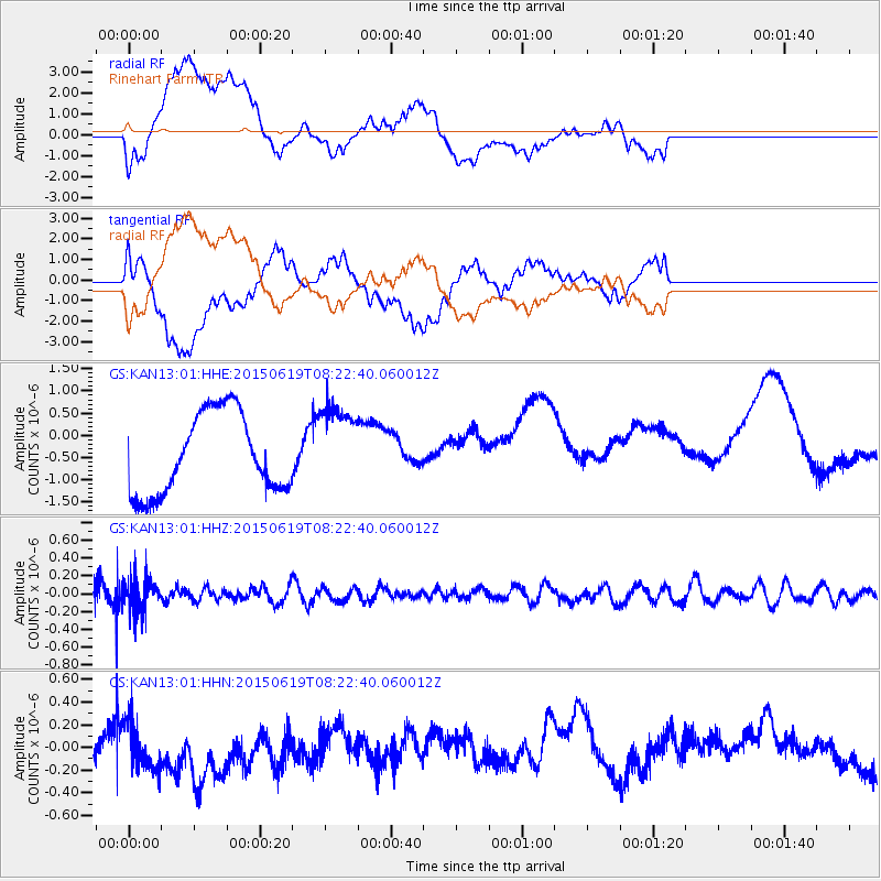
KAN13 Rinehart Farm - Earthquake Result Viewer
*The percent match for this event was below the threshold and hence no stack was calculated.
| Earthquake location: |
Bonin Islands, Japan Region |
| Earthquake latitude/longitude: |
27.0/143.8 |
| Earthquake time(UTC): |
2015/06/19 (170) 08:09:54 GMT |
| Earthquake Depth: |
19 km |
| Earthquake Magnitude: |
4.9 MW |
| Earthquake Catalog/Contributor: |
ISC/ISC |
|
| Network: |
GS US Geological Survey Networks |
| Station: |
KAN13 Rinehart Farm |
| Lat/Lon: |
37.01 N/97.48 W |
| Elevation: |
340 m |
|
| Distance: |
94.2 deg |
| Az: |
44.721 deg |
| Baz: |
308.356 deg |
| Ray Param: |
$rayparam |
*The percent match for this event was below the threshold and hence was not used in the summary stack. |
|
| Radial Match: |
46.690063 % |
| Radial Bump: |
400 |
| Transverse Match: |
47.465256 % |
| Transverse Bump: |
400 |
| SOD ConfigId: |
7422571 |
| Insert Time: |
2019-04-19 09:31:52.142 +0000 |
| GWidth: |
2.5 |
| Max Bumps: |
400 |
| Tol: |
0.001 |
|
Signal To Noise
| Channel | StoN | STA | LTA |
| GS:KAN13:01:HHZ:20150619T08:22:40.060012Z | 1.3212864 | 1.8545484E-7 | 1.403593E-7 |
| GS:KAN13:01:HHN:20150619T08:22:40.060012Z | 1.2149833 | 2.398162E-7 | 1.9738228E-7 |
| GS:KAN13:01:HHE:20150619T08:22:40.060012Z | 1.0703149 | 9.591796E-7 | 8.9616583E-7 |
| Arrivals |
| Ps | |
| PpPs | |
| PsPs/PpSs | |


