You are here: Home > Network List > TA - USArray Transportable Network (new EarthScope stations) Stations List
> Station J01E Myrtle Point, OR, USA > Earthquake Result Viewer
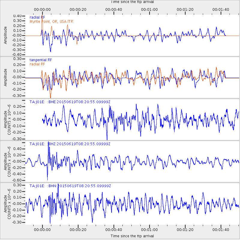
J01E Myrtle Point, OR, USA - Earthquake Result Viewer
*The percent match for this event was below the threshold and hence no stack was calculated.
| Earthquake location: |
Bonin Islands, Japan Region |
| Earthquake latitude/longitude: |
27.0/143.8 |
| Earthquake time(UTC): |
2015/06/19 (170) 08:09:54 GMT |
| Earthquake Depth: |
19 km |
| Earthquake Magnitude: |
4.9 MW |
| Earthquake Catalog/Contributor: |
ISC/ISC |
|
| Network: |
TA USArray Transportable Network (new EarthScope stations) |
| Station: |
J01E Myrtle Point, OR, USA |
| Lat/Lon: |
43.16 N/123.93 W |
| Elevation: |
128 m |
|
| Distance: |
73.6 deg |
| Az: |
49.646 deg |
| Baz: |
291.718 deg |
| Ray Param: |
$rayparam |
*The percent match for this event was below the threshold and hence was not used in the summary stack. |
|
| Radial Match: |
51.540398 % |
| Radial Bump: |
400 |
| Transverse Match: |
49.408146 % |
| Transverse Bump: |
400 |
| SOD ConfigId: |
7422571 |
| Insert Time: |
2019-04-19 09:34:42.958 +0000 |
| GWidth: |
2.5 |
| Max Bumps: |
400 |
| Tol: |
0.001 |
|
Signal To Noise
| Channel | StoN | STA | LTA |
| TA:J01E: :BHZ:20150619T08:20:55.09999Z | 2.61716 | 2.0829658E-7 | 7.958878E-8 |
| TA:J01E: :BHN:20150619T08:20:55.09999Z | 1.4947642 | 1.09122645E-7 | 7.300325E-8 |
| TA:J01E: :BHE:20150619T08:20:55.09999Z | 1.1748456 | 9.1291106E-8 | 7.770477E-8 |
| Arrivals |
| Ps | |
| PpPs | |
| PsPs/PpSs | |


