You are here: Home > Network List > TA - USArray Transportable Network (new EarthScope stations) Stations List
> Station R11A Troy Canyon, Currant, NV, USA > Earthquake Result Viewer
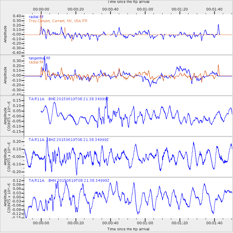
R11A Troy Canyon, Currant, NV, USA - Earthquake Result Viewer
*The percent match for this event was below the threshold and hence no stack was calculated.
| Earthquake location: |
Bonin Islands, Japan Region |
| Earthquake latitude/longitude: |
27.0/143.8 |
| Earthquake time(UTC): |
2015/06/19 (170) 08:09:54 GMT |
| Earthquake Depth: |
19 km |
| Earthquake Magnitude: |
4.9 MW |
| Earthquake Catalog/Contributor: |
ISC/ISC |
|
| Network: |
TA USArray Transportable Network (new EarthScope stations) |
| Station: |
R11A Troy Canyon, Currant, NV, USA |
| Lat/Lon: |
38.35 N/115.59 W |
| Elevation: |
1756 m |
|
| Distance: |
81.4 deg |
| Az: |
51.405 deg |
| Baz: |
297.538 deg |
| Ray Param: |
$rayparam |
*The percent match for this event was below the threshold and hence was not used in the summary stack. |
|
| Radial Match: |
52.85578 % |
| Radial Bump: |
400 |
| Transverse Match: |
37.51153 % |
| Transverse Bump: |
400 |
| SOD ConfigId: |
7422571 |
| Insert Time: |
2019-04-19 09:34:53.145 +0000 |
| GWidth: |
2.5 |
| Max Bumps: |
400 |
| Tol: |
0.001 |
|
Signal To Noise
| Channel | StoN | STA | LTA |
| TA:R11A: :BHZ:20150619T08:21:38.34999Z | 1.0903652 | 9.495667E-8 | 8.708704E-8 |
| TA:R11A: :BHN:20150619T08:21:38.34999Z | 1.1178576 | 8.6650076E-8 | 7.7514414E-8 |
| TA:R11A: :BHE:20150619T08:21:38.34999Z | 0.9562948 | 5.007376E-8 | 5.2362264E-8 |
| Arrivals |
| Ps | |
| PpPs | |
| PsPs/PpSs | |


