You are here: Home > Network List > TA - USArray Transportable Network (new EarthScope stations) Stations List
> Station WHTX Lake Whitney, Meridian, TX, USA > Earthquake Result Viewer
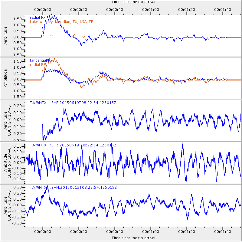
WHTX Lake Whitney, Meridian, TX, USA - Earthquake Result Viewer
*The percent match for this event was below the threshold and hence no stack was calculated.
| Earthquake location: |
Bonin Islands, Japan Region |
| Earthquake latitude/longitude: |
27.0/143.8 |
| Earthquake time(UTC): |
2015/06/19 (170) 08:09:54 GMT |
| Earthquake Depth: |
19 km |
| Earthquake Magnitude: |
4.9 MW |
| Earthquake Catalog/Contributor: |
ISC/ISC |
|
| Network: |
TA USArray Transportable Network (new EarthScope stations) |
| Station: |
WHTX Lake Whitney, Meridian, TX, USA |
| Lat/Lon: |
31.99 N/97.46 W |
| Elevation: |
190 m |
|
| Distance: |
97.3 deg |
| Az: |
48.667 deg |
| Baz: |
307.976 deg |
| Ray Param: |
$rayparam |
*The percent match for this event was below the threshold and hence was not used in the summary stack. |
|
| Radial Match: |
44.261555 % |
| Radial Bump: |
400 |
| Transverse Match: |
39.898186 % |
| Transverse Bump: |
400 |
| SOD ConfigId: |
7422571 |
| Insert Time: |
2019-04-19 09:34:57.188 +0000 |
| GWidth: |
2.5 |
| Max Bumps: |
400 |
| Tol: |
0.001 |
|
Signal To Noise
| Channel | StoN | STA | LTA |
| TA:WHTX: :BHZ:20150619T08:22:54.125015Z | 0.68525547 | 5.3237795E-8 | 7.769044E-8 |
| TA:WHTX: :BHN:20150619T08:22:54.125015Z | 0.42994794 | 1.0544427E-7 | 2.4524894E-7 |
| TA:WHTX: :BHE:20150619T08:22:54.125015Z | 0.79842544 | 9.3016226E-8 | 1.1649958E-7 |
| Arrivals |
| Ps | |
| PpPs | |
| PsPs/PpSs | |


