You are here: Home > Network List > IU - Global Seismograph Network (GSN - IRIS/USGS) Stations List
> Station SLBS Sierra la Laguna Baja California Sur, Mexico > Earthquake Result Viewer
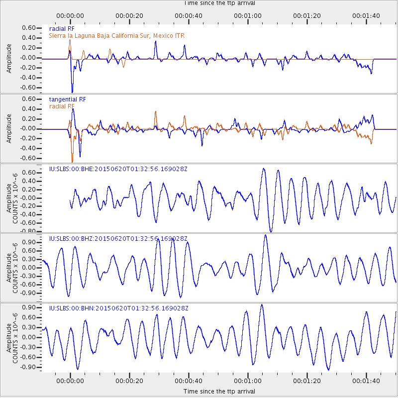
SLBS Sierra la Laguna Baja California Sur, Mexico - Earthquake Result Viewer
*The percent match for this event was below the threshold and hence no stack was calculated.
| Earthquake location: |
South Of Tonga Islands |
| Earthquake latitude/longitude: |
-24.6/-175.6 |
| Earthquake time(UTC): |
2015/06/20 (171) 01:21:21 GMT |
| Earthquake Depth: |
19 km |
| Earthquake Magnitude: |
4.7 mb |
| Earthquake Catalog/Contributor: |
ISC/ISC |
|
| Network: |
IU Global Seismograph Network (GSN - IRIS/USGS) |
| Station: |
SLBS Sierra la Laguna Baja California Sur, Mexico |
| Lat/Lon: |
23.69 N/109.94 W |
| Elevation: |
825 m |
|
| Distance: |
79.7 deg |
| Az: |
58.084 deg |
| Baz: |
237.469 deg |
| Ray Param: |
$rayparam |
*The percent match for this event was below the threshold and hence was not used in the summary stack. |
|
| Radial Match: |
49.12015 % |
| Radial Bump: |
400 |
| Transverse Match: |
58.84351 % |
| Transverse Bump: |
400 |
| SOD ConfigId: |
7422571 |
| Insert Time: |
2019-04-19 09:39:59.884 +0000 |
| GWidth: |
2.5 |
| Max Bumps: |
400 |
| Tol: |
0.001 |
|
Signal To Noise
| Channel | StoN | STA | LTA |
| IU:SLBS:00:BHZ:20150620T01:32:56.169028Z | 2.7664611 | 6.0231633E-7 | 2.1772087E-7 |
| IU:SLBS:00:BHN:20150620T01:32:56.169028Z | 2.0394542 | 5.322705E-7 | 2.6098672E-7 |
| IU:SLBS:00:BHE:20150620T01:32:56.169028Z | 1.5672143 | 2.687156E-7 | 1.7146067E-7 |
| Arrivals |
| Ps | |
| PpPs | |
| PsPs/PpSs | |


