MA2 Magadan, Russia - Earthquake Result Viewer
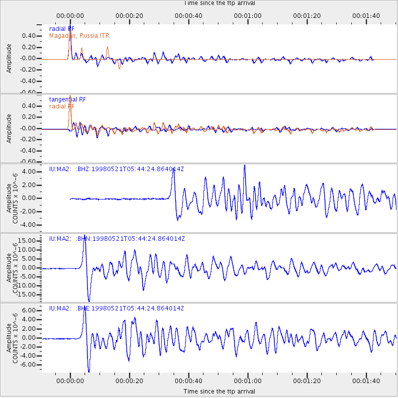
Earthquake location: Minahassa Peninsula, Sulawesi
Earthquake latitude/longitude: 0.2/119.6
Earthquake time(UTC): 1998/05/21 (141) 05:34:25 GMT
Earthquake Depth: 33 km
Earthquake Magnitude: 6.2 MB, 6.3 MS, 6.6 UNKNOWN, 6.6 MW
Earthquake Catalog/Contributor: WHDF/NEIC
Network: IU Global Seismograph Network (GSN - IRIS/USGS)
Station: MA2 Magadan, Russia
Lat/Lon: 59.58 N/150.77 E
Elevation: 339 m
Distance: 64.0 deg
Az: 17.051 deg
Baz: 215.18 deg
Ray Param: 0.059158117
Estimated Moho Depth: 58.5 km
Estimated Crust Vp/Vs: 2.10
Assumed Crust Vp: 6.134 km/s
Estimated Crust Vs: 2.924 km/s
Estimated Crust Poisson's Ratio: 0.35
Radial Match: 96.456985 %
Radial Bump: 373
Transverse Match: 93.30906 %
Transverse Bump: 400
SOD ConfigId: 4480
Insert Time: 2010-03-03 14:53:57.089 +0000
GWidth: 2.5
Max Bumps: 400
Tol: 0.001

Signal To Noise

ChannelStoNSTALTA
IU:MA2: :BHN:19980521T05:44:24.864014Z126.248425.4257225E-64.2976556E-8
IU:MA2: :BHE:19980521T05:44:24.864014Z56.664252.032035E-63.5860968E-8
IU:MA2: :BHZ:19980521T05:44:24.864014Z30.409881.2765988E-64.197974E-8
Arrivals
Ps11 SECOND
PpPs29 SECOND
PsPs/PpSs39 SECOND