MA2 Magadan, Russia - Earthquake Result Viewer
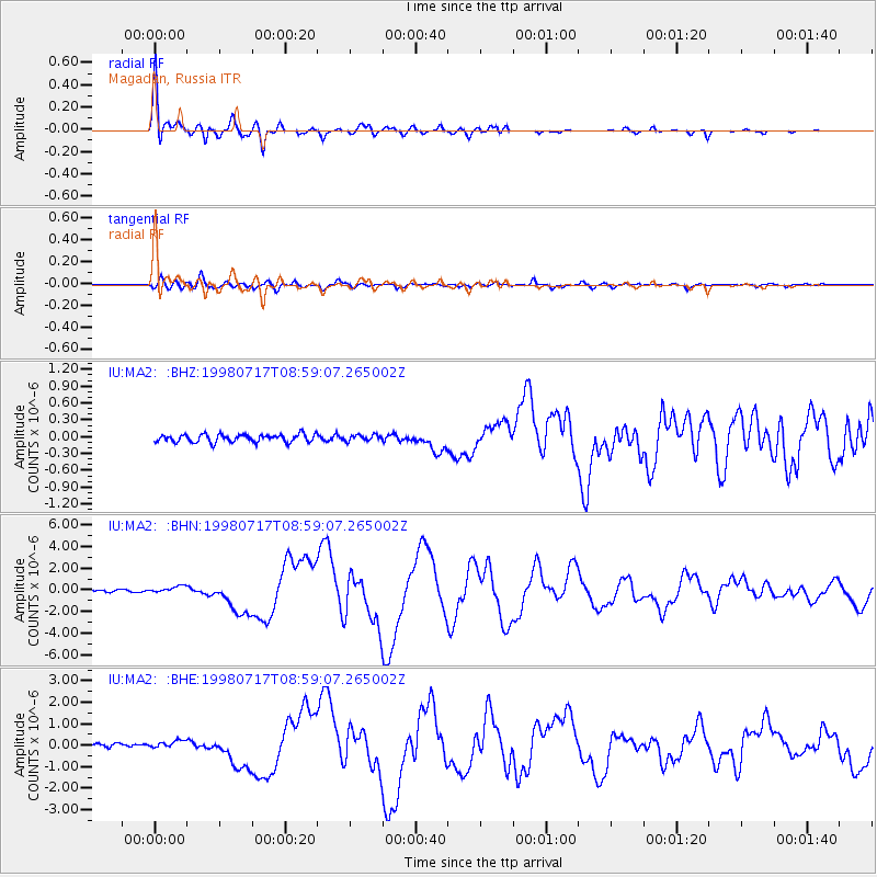
Earthquake location: Near N Coast Of New Guinea, P.N.G.
Earthquake latitude/longitude: -3.0/141.9
Earthquake time(UTC): 1998/07/17 (198) 08:49:13 GMT
Earthquake Depth: 10 km
Earthquake Magnitude: 5.8 MB, 7.1 MS, 7.1 UNKNOWN, 6.4 ME
Earthquake Catalog/Contributor: WHDF/NEIC
Network: IU Global Seismograph Network (GSN - IRIS/USGS)
Station: MA2 Magadan, Russia
Lat/Lon: 59.58 N/150.77 E
Elevation: 339 m
Distance: 62.7 deg
Az: 5.05 deg
Baz: 189.946 deg
Ray Param: 0.060029835
Estimated Moho Depth: 25.25 km
Estimated Crust Vp/Vs: 2.07
Assumed Crust Vp: 6.134 km/s
Estimated Crust Vs: 2.967 km/s
Estimated Crust Poisson's Ratio: 0.35
Radial Match: 98.32223 %
Radial Bump: 400
Transverse Match: 90.69479 %
Transverse Bump: 400
SOD ConfigId: 4480
Insert Time: 2010-03-03 14:54:11.312 +0000
GWidth: 2.5
Max Bumps: 400
Tol: 0.001

Signal To Noise

ChannelStoNSTALTA
IU:MA2: :BHN:19980717T08:59:07.265002Z3.82088453.3234988E-78.6982446E-8
IU:MA2: :BHE:19980717T08:59:07.265002Z2.42994641.724513E-77.096918E-8
IU:MA2: :BHZ:19980717T08:59:07.265002Z0.765102865.280259E-86.9013716E-8
Arrivals
Ps4.5 SECOND
PpPs12 SECOND
PsPs/PpSs17 SECOND