MA2 Magadan, Russia - Earthquake Result Viewer
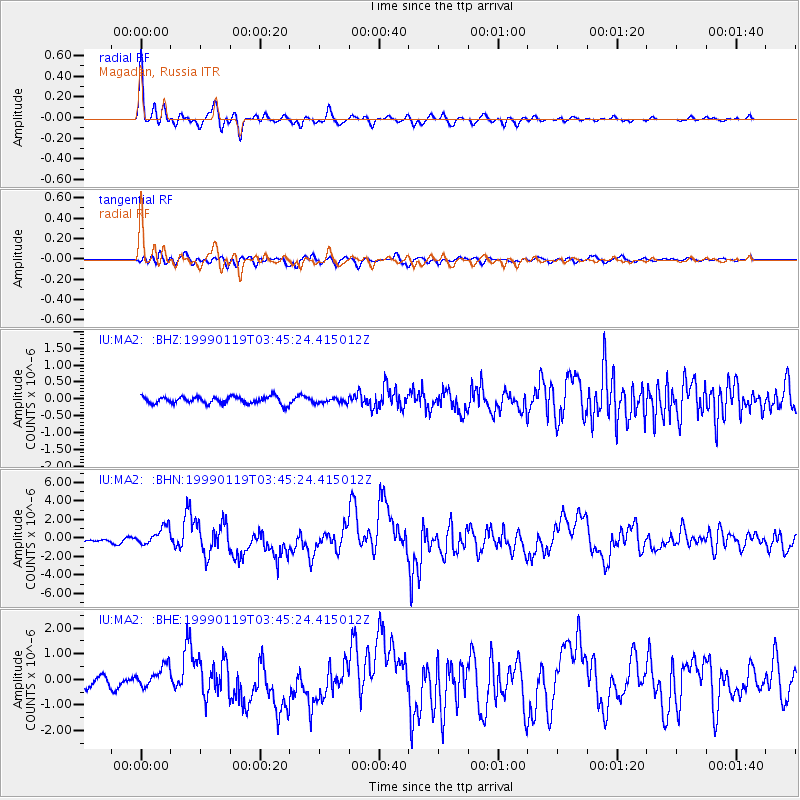
Earthquake location: New Ireland Region, P.N.G.
Earthquake latitude/longitude: -4.6/153.2
Earthquake time(UTC): 1999/01/19 (019) 03:35:33 GMT
Earthquake Depth: 114 km
Earthquake Magnitude: 5.8 MB, 6.4 MS, 7.0 MW, 6.5 ME
Earthquake Catalog/Contributor: WHDF/NEIC
Network: IU Global Seismograph Network (GSN - IRIS/USGS)
Station: MA2 Magadan, Russia
Lat/Lon: 59.58 N/150.77 E
Elevation: 339 m
Distance: 64.0 deg
Az: 358.605 deg
Baz: 177.266 deg
Ray Param: 0.058891825
Estimated Moho Depth: 29.0 km
Estimated Crust Vp/Vs: 1.81
Assumed Crust Vp: 6.134 km/s
Estimated Crust Vs: 3.384 km/s
Estimated Crust Poisson's Ratio: 0.28
Radial Match: 95.99447 %
Radial Bump: 400
Transverse Match: 83.69042 %
Transverse Bump: 400
SOD ConfigId: 4480
Insert Time: 2010-03-03 14:55:08.311 +0000
GWidth: 2.5
Max Bumps: 400
Tol: 0.001

Signal To Noise

ChannelStoNSTALTA
IU:MA2: :BHN:19990119T03:45:24.415012Z7.6692319.712469E-71.2664202E-7
IU:MA2: :BHE:19990119T03:45:24.415012Z2.3691384.2024814E-71.7738442E-7
IU:MA2: :BHZ:19990119T03:45:24.415012Z0.683261047.23444E-81.0588105E-7
Arrivals
Ps4.0 SECOND
PpPs13 SECOND
PsPs/PpSs17 SECOND