You are here: Home > Network List > TA - USArray Transportable Network (new EarthScope stations) Stations List
> Station O03E Paynes Creek, CA, USA > Earthquake Result Viewer
O03E Paynes Creek, CA, USA - Earthquake Result Viewer
| Earthquake location: |
Near Coast Of Central Chile |
| Earthquake latitude/longitude: |
-36.3/-73.8 |
| Earthquake time(UTC): |
2015/06/20 (171) 02:10:06 GMT |
| Earthquake Depth: |
10 km |
| Earthquake Magnitude: |
6.4 MO |
| Earthquake Catalog/Contributor: |
NEIC PDE/NEIC ALERT |
|
| Network: |
TA USArray Transportable Network (new EarthScope stations) |
| Station: |
O03E Paynes Creek, CA, USA |
| Lat/Lon: |
40.29 N/121.80 W |
| Elevation: |
967 m |
|
| Distance: |
88.1 deg |
| Az: |
325.348 deg |
| Baz: |
143.108 deg |
| Ray Param: |
0.042849895 |
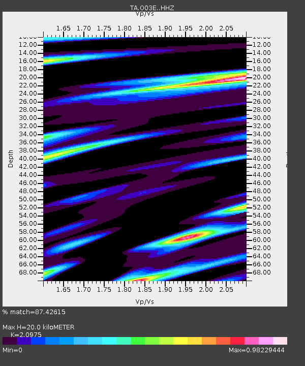
| Estimated Moho Depth: |
20.0 km |
| Estimated Crust Vp/Vs: |
2.10 |
| Assumed Crust Vp: |
6.566 km/s |
| Estimated Crust Vs: |
3.13 km/s |
| Estimated Crust Poisson's Ratio: |
0.35 |
|
| Radial Match: |
87.42615 % |
| Radial Bump: |
400 |
| Transverse Match: |
84.36016 % |
| Transverse Bump: |
400 |
| SOD ConfigId: |
7422571 |
| Insert Time: |
2019-04-19 09:51:41.617 +0000 |
| GWidth: |
2.5 |
| Max Bumps: |
400 |
| Tol: |
0.001 |
|
Signal To Noise
| Channel | StoN | STA | LTA |
| TA:O03E: :HHZ:20150620T02:22:25.869971Z | 2.9960046 | 1.4082062E-7 | 4.7002807E-8 |
| TA:O03E: :HHN:20150620T02:22:25.869971Z | 1.4486417 | 8.2022865E-8 | 5.6620536E-8 |
| TA:O03E: :HHE:20150620T02:22:25.869971Z | 0.70447725 | 5.9359508E-8 | 8.426036E-8 |
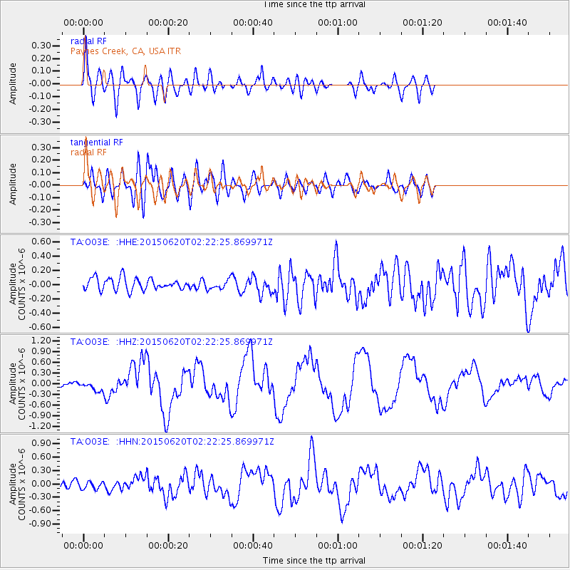
| Arrivals |
| Ps | 3.4 SECOND |
| PpPs | 9.3 SECOND |
| PsPs/PpSs | 13 SECOND |


