You are here: Home > Network List > UW - Pacific Northwest Regional Seismic Network Stations List
> Station MRBL Marblemount, WA, USA > Earthquake Result Viewer
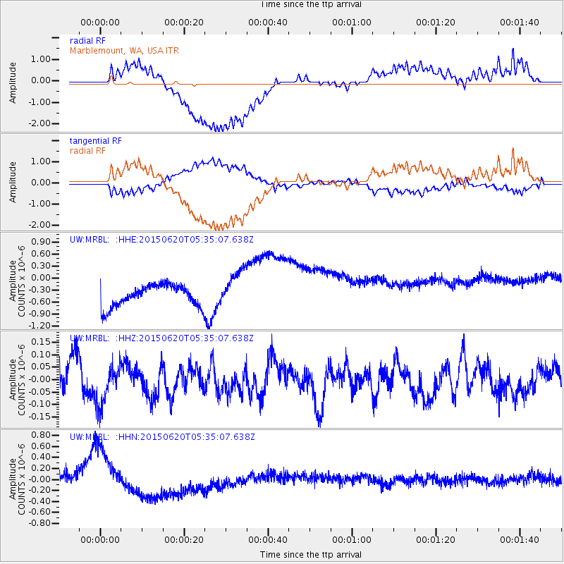
MRBL Marblemount, WA, USA - Earthquake Result Viewer
*The percent match for this event was below the threshold and hence no stack was calculated.
| Earthquake location: |
Near Coast Of Central Chile |
| Earthquake latitude/longitude: |
-36.3/-73.7 |
| Earthquake time(UTC): |
2015/06/20 (171) 05:22:19 GMT |
| Earthquake Depth: |
30 km |
| Earthquake Magnitude: |
5.5 MWR |
| Earthquake Catalog/Contributor: |
NEIC PDE/NEIC COMCAT |
|
| Network: |
UW Pacific Northwest Regional Seismic Network |
| Station: |
MRBL Marblemount, WA, USA |
| Lat/Lon: |
48.52 N/121.48 W |
| Elevation: |
75 m |
|
| Distance: |
94.5 deg |
| Az: |
330.411 deg |
| Baz: |
143.122 deg |
| Ray Param: |
$rayparam |
*The percent match for this event was below the threshold and hence was not used in the summary stack. |
|
| Radial Match: |
40.968075 % |
| Radial Bump: |
400 |
| Transverse Match: |
43.60025 % |
| Transverse Bump: |
400 |
| SOD ConfigId: |
7422571 |
| Insert Time: |
2019-04-19 10:00:08.416 +0000 |
| GWidth: |
2.5 |
| Max Bumps: |
400 |
| Tol: |
0.001 |
|
Signal To Noise
| Channel | StoN | STA | LTA |
| UW:MRBL: :HHZ:20150620T05:35:07.638Z | 1.3338947 | 8.1345476E-8 | 6.098343E-8 |
| UW:MRBL: :HHN:20150620T05:35:07.638Z | 1.8469665 | 2.985859E-7 | 1.6166287E-7 |
| UW:MRBL: :HHE:20150620T05:35:07.638Z | 1.3855811 | 3.6460568E-7 | 2.631428E-7 |
| Arrivals |
| Ps | |
| PpPs | |
| PsPs/PpSs | |


