MA2 Magadan, Russia - Earthquake Result Viewer
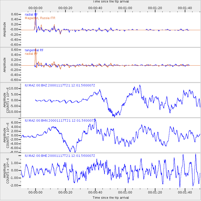
Earthquake location: New Britain Region, P.N.G.
Earthquake latitude/longitude: -5.5/151.8
Earthquake time(UTC): 2000/11/17 (322) 21:01:56 GMT
Earthquake Depth: 33 km
Earthquake Magnitude: 6.2 MB, 8.0 MS, 7.6 MW, 6.9 ME
Earthquake Catalog/Contributor: WHDF/NEIC
Network: IU Global Seismograph Network (GSN - IRIS/USGS)
Station: MA2 Magadan, Russia
Lat/Lon: 59.58 N/150.77 E
Elevation: 339 m
Distance: 64.9 deg
Az: 359.432 deg
Baz: 178.888 deg
Ray Param: 0.058590442
Estimated Moho Depth: 28.5 km
Estimated Crust Vp/Vs: 1.84
Assumed Crust Vp: 6.134 km/s
Estimated Crust Vs: 3.338 km/s
Estimated Crust Poisson's Ratio: 0.29
Radial Match: 96.94186 %
Radial Bump: 353
Transverse Match: 64.879906 %
Transverse Bump: 400
SOD ConfigId: 3744
Insert Time: 2010-03-03 14:57:00.948 +0000
GWidth: 2.5
Max Bumps: 400
Tol: 0.001

Signal To Noise

ChannelStoNSTALTA
IU:MA2:00:BHN:20001117T21:12:01.560007Z1.45930915.321416E-73.646531E-7
IU:MA2:00:BHE:20001117T21:12:01.560007Z0.581733762.8025536E-74.817588E-7
IU:MA2:00:BHZ:20001117T21:12:01.560007Z1.7486981.1031347E-66.30832E-7
Arrivals
Ps4.0 SECOND
PpPs13 SECOND
PsPs/PpSs17 SECOND