You are here: Home > Network List > IU - Global Seismograph Network (GSN - IRIS/USGS) Stations List
> Station MA2 Magadan, Russia > Earthquake Result Viewer
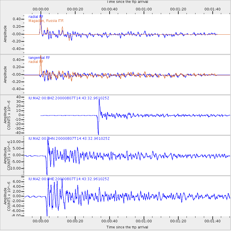
MA2 Magadan, Russia - Earthquake Result Viewer

| Earthquake location: |
Banda Sea |
| Earthquake latitude/longitude: |
-7.0/123.4 |
| Earthquake time(UTC): |
2000/08/07 (220) 14:33:55 GMT |
| Earthquake Depth: |
648 km |
| Earthquake Magnitude: |
6.5 MB, 6.5 MW, 6.5 MW |
| Earthquake Catalog/Contributor: |
WHDF/NEIC |
|
| Network: |
IU Global Seismograph Network (GSN - IRIS/USGS) |
| Station: |
MA2 Magadan, Russia |
| Lat/Lon: |
59.58 N/150.77 E |
| Elevation: |
339 m |
|
| Distance: |
69.9 deg |
| Az: |
14.45 deg |
| Baz: |
209.124 deg |
| Ray Param: |
0.05303379 |
| Estimated Moho Depth: |
28.5 km |
| Estimated Crust Vp/Vs: |
1.82 |
| Assumed Crust Vp: |
6.134 km/s |
| Estimated Crust Vs: |
3.375 km/s |
| Estimated Crust Poisson's Ratio: |
0.28 |
|
| Radial Match: |
96.87557 % |
| Radial Bump: |
400 |
| Transverse Match: |
95.39324 % |
| Transverse Bump: |
400 |
| SOD ConfigId: |
3744 |
| Insert Time: |
2010-03-03 14:57:25.805 +0000 |
| GWidth: |
2.5 |
| Max Bumps: |
400 |
| Tol: |
0.001 |
|
Signal To Noise
| Channel | StoN | STA | LTA |
| IU:MA2:00:BHN:20000807T14:43:32.961025Z | 32.646805 | 5.418972E-6 | 1.6598783E-7 |
| IU:MA2:00:BHE:20000807T14:43:32.961025Z | 19.362894 | 2.4970918E-6 | 1.2896274E-7 |
| IU:MA2:00:BHZ:20000807T14:43:32.961025Z | 109.97108 | 1.5014351E-5 | 1.3653E-7 |
| Arrivals |
| Ps | 3.9 SECOND |
| PpPs | 13 SECOND |
| PsPs/PpSs | 17 SECOND |


