You are here: Home > Network List > AV - Alaska Volcano Observatory Stations List
> Station SPCR Ckakachatna River, Mount Spurr, Alaska > Earthquake Result Viewer
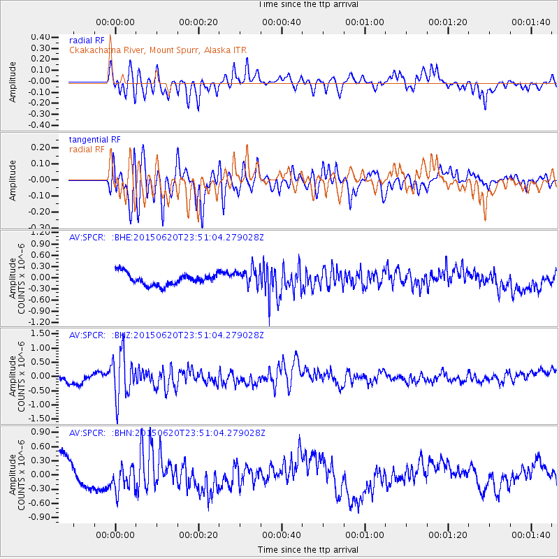
SPCR Ckakachatna River, Mount Spurr, Alaska - Earthquake Result Viewer
*The percent match for this event was below the threshold and hence no stack was calculated.
| Earthquake location: |
South Of Fiji Islands |
| Earthquake latitude/longitude: |
-23.6/-177.1 |
| Earthquake time(UTC): |
2015/06/20 (171) 23:39:09 GMT |
| Earthquake Depth: |
158 km |
| Earthquake Magnitude: |
5.9 MO |
| Earthquake Catalog/Contributor: |
NEIC PDE/NEIC ALERT |
|
| Network: |
AV Alaska Volcano Observatory |
| Station: |
SPCR Ckakachatna River, Mount Spurr, Alaska |
| Lat/Lon: |
61.20 N/152.21 W |
| Elevation: |
984 m |
|
| Distance: |
86.8 deg |
| Az: |
11.778 deg |
| Baz: |
202.756 deg |
| Ray Param: |
$rayparam |
*The percent match for this event was below the threshold and hence was not used in the summary stack. |
|
| Radial Match: |
48.690464 % |
| Radial Bump: |
400 |
| Transverse Match: |
50.73993 % |
| Transverse Bump: |
400 |
| SOD ConfigId: |
7422571 |
| Insert Time: |
2019-04-19 10:06:27.993 +0000 |
| GWidth: |
2.5 |
| Max Bumps: |
400 |
| Tol: |
0.001 |
|
Signal To Noise
| Channel | StoN | STA | LTA |
| AV:SPCR: :BHZ:20150620T23:51:04.279028Z | 5.8293343 | 8.116115E-7 | 1.3922885E-7 |
| AV:SPCR: :BHN:20150620T23:51:04.279028Z | 0.828109 | 2.6907486E-7 | 3.2492684E-7 |
| AV:SPCR: :BHE:20150620T23:51:04.279028Z | 1.8226753 | 2.7167087E-7 | 1.4905062E-7 |
| Arrivals |
| Ps | |
| PpPs | |
| PsPs/PpSs | |


