You are here: Home > Network List > US - United States National Seismic Network Stations List
> Station DGMT Dagmar, Montana, USA > Earthquake Result Viewer
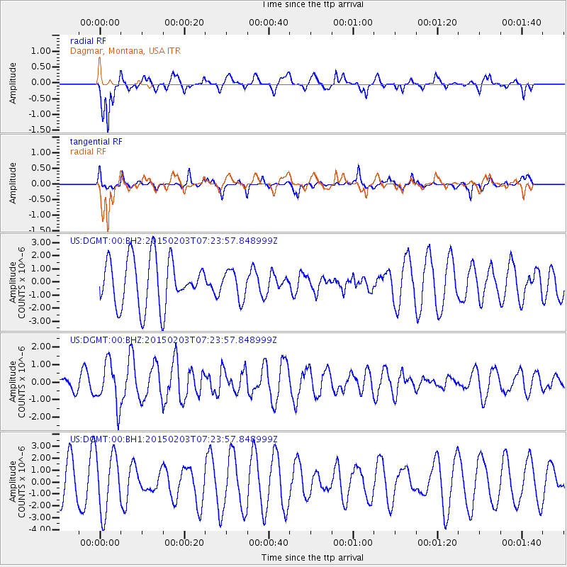
DGMT Dagmar, Montana, USA - Earthquake Result Viewer
*The percent match for this event was below the threshold and hence no stack was calculated.
| Earthquake location: |
Fox Islands, Aleutian Islands |
| Earthquake latitude/longitude: |
52.3/-168.6 |
| Earthquake time(UTC): |
2015/02/03 (034) 07:16:54 GMT |
| Earthquake Depth: |
16 km |
| Earthquake Magnitude: |
5.6 MB |
| Earthquake Catalog/Contributor: |
NEIC PDE/NEIC ALERT |
|
| Network: |
US United States National Seismic Network |
| Station: |
DGMT Dagmar, Montana, USA |
| Lat/Lon: |
48.47 N/104.20 W |
| Elevation: |
0.0 m |
|
| Distance: |
40.0 deg |
| Az: |
68.93 deg |
| Baz: |
300.633 deg |
| Ray Param: |
$rayparam |
*The percent match for this event was below the threshold and hence was not used in the summary stack. |
|
| Radial Match: |
66.93928 % |
| Radial Bump: |
400 |
| Transverse Match: |
59.52637 % |
| Transverse Bump: |
356 |
| SOD ConfigId: |
837871 |
| Insert Time: |
2015-02-17 07:46:35.742 +0000 |
| GWidth: |
2.5 |
| Max Bumps: |
400 |
| Tol: |
0.001 |
|
Signal To Noise
| Channel | StoN | STA | LTA |
| US:DGMT:00:BHZ:20150203T07:23:57.848999Z | 2.4163144 | 1.2556078E-6 | 5.196376E-7 |
| US:DGMT:00:BH1:20150203T07:23:57.848999Z | 1.5211475 | 2.4336377E-6 | 1.5998696E-6 |
| US:DGMT:00:BH2:20150203T07:23:57.848999Z | 0.5924389 | 1.0943905E-6 | 1.8472632E-6 |
| Arrivals |
| Ps | |
| PpPs | |
| PsPs/PpSs | |


