You are here: Home > Network List > CN - Canadian National Seismograph Network Stations List
> Station INK INUVIK, NT > Earthquake Result Viewer
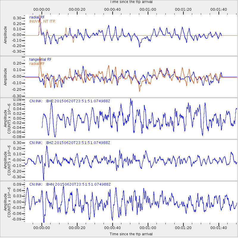
INK INUVIK, NT - Earthquake Result Viewer
*The percent match for this event was below the threshold and hence no stack was calculated.
| Earthquake location: |
South Of Fiji Islands |
| Earthquake latitude/longitude: |
-23.6/-177.1 |
| Earthquake time(UTC): |
2015/06/20 (171) 23:39:09 GMT |
| Earthquake Depth: |
158 km |
| Earthquake Magnitude: |
5.9 MO |
| Earthquake Catalog/Contributor: |
NEIC PDE/NEIC ALERT |
|
| Network: |
CN Canadian National Seismograph Network |
| Station: |
INK INUVIK, NT |
| Lat/Lon: |
68.31 N/133.53 W |
| Elevation: |
44 m |
|
| Distance: |
97.0 deg |
| Az: |
14.963 deg |
| Baz: |
219.587 deg |
| Ray Param: |
$rayparam |
*The percent match for this event was below the threshold and hence was not used in the summary stack. |
|
| Radial Match: |
66.28674 % |
| Radial Bump: |
400 |
| Transverse Match: |
48.562263 % |
| Transverse Bump: |
400 |
| SOD ConfigId: |
7422571 |
| Insert Time: |
2019-04-19 10:08:08.909 +0000 |
| GWidth: |
2.5 |
| Max Bumps: |
400 |
| Tol: |
0.001 |
|
Signal To Noise
| Channel | StoN | STA | LTA |
| CN:INK: :BHZ:20150620T23:51:51.074988Z | 2.4809077 | 1.3877171E-7 | 5.5935857E-8 |
| CN:INK: :BHN:20150620T23:51:51.074988Z | 1.422297 | 4.6594163E-8 | 3.2759797E-8 |
| CN:INK: :BHE:20150620T23:51:51.074988Z | 0.68606216 | 2.0215213E-8 | 2.946557E-8 |
| Arrivals |
| Ps | |
| PpPs | |
| PsPs/PpSs | |


