You are here: Home > Network List > TA - USArray Transportable Network (new EarthScope stations) Stations List
> Station 435B Jarrell, TX, USA > Earthquake Result Viewer
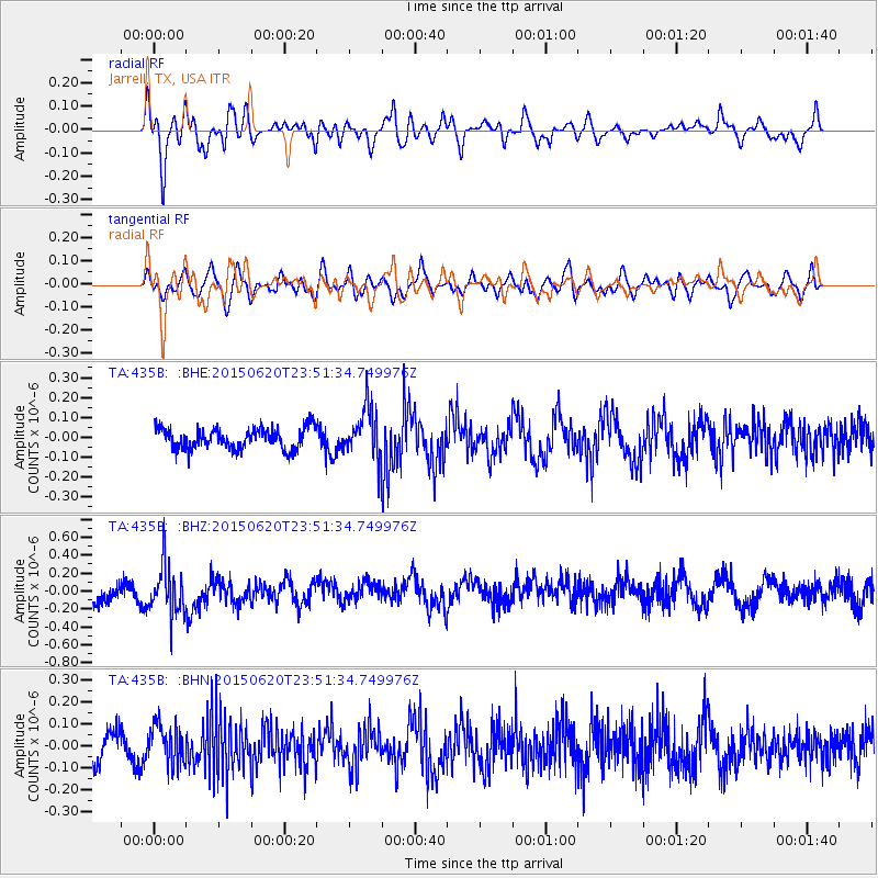
435B Jarrell, TX, USA - Earthquake Result Viewer
*The percent match for this event was below the threshold and hence no stack was calculated.
| Earthquake location: |
South Of Fiji Islands |
| Earthquake latitude/longitude: |
-23.6/-177.1 |
| Earthquake time(UTC): |
2015/06/20 (171) 23:39:09 GMT |
| Earthquake Depth: |
158 km |
| Earthquake Magnitude: |
5.9 MO |
| Earthquake Catalog/Contributor: |
NEIC PDE/NEIC ALERT |
|
| Network: |
TA USArray Transportable Network (new EarthScope stations) |
| Station: |
435B Jarrell, TX, USA |
| Lat/Lon: |
30.78 N/97.58 W |
| Elevation: |
248 m |
|
| Distance: |
93.4 deg |
| Az: |
57.964 deg |
| Baz: |
244.669 deg |
| Ray Param: |
$rayparam |
*The percent match for this event was below the threshold and hence was not used in the summary stack. |
|
| Radial Match: |
77.56319 % |
| Radial Bump: |
400 |
| Transverse Match: |
51.58759 % |
| Transverse Bump: |
400 |
| SOD ConfigId: |
7422571 |
| Insert Time: |
2019-04-19 10:10:43.644 +0000 |
| GWidth: |
2.5 |
| Max Bumps: |
400 |
| Tol: |
0.001 |
|
Signal To Noise
| Channel | StoN | STA | LTA |
| TA:435B: :BHZ:20150620T23:51:34.749976Z | 2.3299894 | 2.7692425E-7 | 1.1885214E-7 |
| TA:435B: :BHN:20150620T23:51:34.749976Z | 1.6600901 | 9.3068074E-8 | 5.6062063E-8 |
| TA:435B: :BHE:20150620T23:51:34.749976Z | 3.0392258 | 1.5643501E-7 | 5.1471993E-8 |
| Arrivals |
| Ps | |
| PpPs | |
| PsPs/PpSs | |


