You are here: Home > Network List > TA - USArray Transportable Network (new EarthScope stations) Stations List
> Station G03D McMinnville, OR, USA > Earthquake Result Viewer
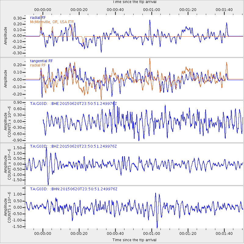
G03D McMinnville, OR, USA - Earthquake Result Viewer
*The percent match for this event was below the threshold and hence no stack was calculated.
| Earthquake location: |
South Of Fiji Islands |
| Earthquake latitude/longitude: |
-23.6/-177.1 |
| Earthquake time(UTC): |
2015/06/20 (171) 23:39:09 GMT |
| Earthquake Depth: |
158 km |
| Earthquake Magnitude: |
5.9 MO |
| Earthquake Catalog/Contributor: |
NEIC PDE/NEIC ALERT |
|
| Network: |
TA USArray Transportable Network (new EarthScope stations) |
| Station: |
G03D McMinnville, OR, USA |
| Lat/Lon: |
45.21 N/123.26 W |
| Elevation: |
222 m |
|
| Distance: |
84.2 deg |
| Az: |
35.005 deg |
| Baz: |
228.131 deg |
| Ray Param: |
$rayparam |
*The percent match for this event was below the threshold and hence was not used in the summary stack. |
|
| Radial Match: |
48.43692 % |
| Radial Bump: |
400 |
| Transverse Match: |
65.99676 % |
| Transverse Bump: |
400 |
| SOD ConfigId: |
7422571 |
| Insert Time: |
2019-04-19 10:10:51.877 +0000 |
| GWidth: |
2.5 |
| Max Bumps: |
400 |
| Tol: |
0.001 |
|
Signal To Noise
| Channel | StoN | STA | LTA |
| TA:G03D: :BHZ:20150620T23:50:51.249976Z | 2.8960288 | 8.415785E-7 | 2.9059743E-7 |
| TA:G03D: :BHN:20150620T23:50:51.249976Z | 1.2495948 | 3.326226E-7 | 2.6618434E-7 |
| TA:G03D: :BHE:20150620T23:50:51.249976Z | 1.4557686 | 3.3837085E-7 | 2.324345E-7 |
| Arrivals |
| Ps | |
| PpPs | |
| PsPs/PpSs | |


