MA2 Magadan, Russia - Earthquake Result Viewer
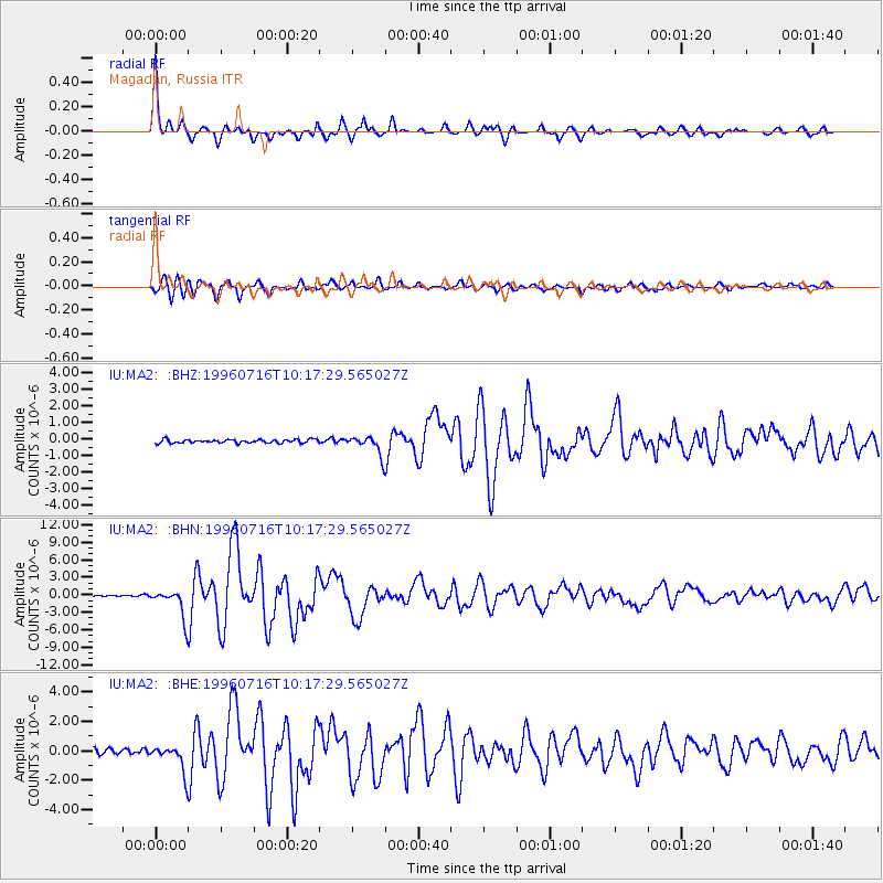
Earthquake location: Minahassa Peninsula, Sulawesi
Earthquake latitude/longitude: 1.0/120.3
Earthquake time(UTC): 1996/07/16 (198) 10:07:36 GMT
Earthquake Depth: 33 km
Earthquake Magnitude: 6.0 MB, 6.4 MS, 6.6 UNKNOWN, 6.6 MW
Earthquake Catalog/Contributor: WHDF/NEIC
Network: IU Global Seismograph Network (GSN - IRIS/USGS)
Station: MA2 Magadan, Russia
Lat/Lon: 59.58 N/150.77 E
Elevation: 339 m
Distance: 63.0 deg
Az: 16.856 deg
Baz: 214.726 deg
Ray Param: 0.05978767
Estimated Moho Depth: 17.5 km
Estimated Crust Vp/Vs: 1.72
Assumed Crust Vp: 6.134 km/s
Estimated Crust Vs: 3.561 km/s
Estimated Crust Poisson's Ratio: 0.25
Radial Match: 97.70092 %
Radial Bump: 328
Transverse Match: 92.82325 %
Transverse Bump: 400
SOD ConfigId: 4480
Insert Time: 2010-03-03 14:59:40.782 +0000
GWidth: 2.5
Max Bumps: 400
Tol: 0.001

Signal To Noise

ChannelStoNSTALTA
IU:MA2: :BHN:19960716T10:17:29.565027Z24.6836032.4349865E-69.864794E-8
IU:MA2: :BHE:19960716T10:17:29.565027Z5.3497958.993627E-71.6811163E-7
IU:MA2: :BHZ:19960716T10:17:29.565027Z5.54648925.7541064E-71.0374322E-7
Arrivals
Ps2.1 SECOND
PpPs7.5 SECOND
PsPs/PpSs9.6 SECOND