MA2 Magadan, Russia - Earthquake Result Viewer
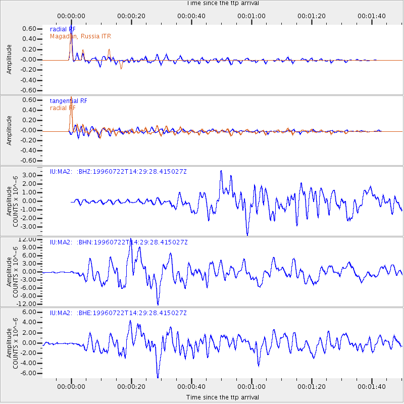
Earthquake location: Minahassa Peninsula, Sulawesi
Earthquake latitude/longitude: 1.0/120.4
Earthquake time(UTC): 1996/07/22 (204) 14:19:35 GMT
Earthquake Depth: 33 km
Earthquake Magnitude: 6.0 MB, 6.9 MS, 7.0 UNKNOWN, 6.9 MW
Earthquake Catalog/Contributor: WHDF/NEIC
Network: IU Global Seismograph Network (GSN - IRIS/USGS)
Station: MA2 Magadan, Russia
Lat/Lon: 59.58 N/150.77 E
Elevation: 339 m
Distance: 63.0 deg
Az: 16.761 deg
Baz: 214.511 deg
Ray Param: 0.059814483
Estimated Moho Depth: 19.0 km
Estimated Crust Vp/Vs: 1.62
Assumed Crust Vp: 6.134 km/s
Estimated Crust Vs: 3.786 km/s
Estimated Crust Poisson's Ratio: 0.19
Radial Match: 97.21055 %
Radial Bump: 341
Transverse Match: 89.89879 %
Transverse Bump: 400
SOD ConfigId: 4480
Insert Time: 2010-03-03 14:59:54.073 +0000
GWidth: 2.5
Max Bumps: 400
Tol: 0.001

Signal To Noise

ChannelStoNSTALTA
IU:MA2: :BHN:19960722T14:29:28.415027Z9.559661.0385601E-61.0863985E-7
IU:MA2: :BHE:19960722T14:29:28.415027Z1.96246674.1489875E-72.1141696E-7
IU:MA2: :BHZ:19960722T14:29:28.415027Z2.25322533.4495704E-71.5309479E-7
Arrivals
Ps2.0 SECOND
PpPs7.8 SECOND
PsPs/PpSs9.8 SECOND