You are here: Home > Network List > UW - Pacific Northwest Regional Seismic Network Stations List
> Station HOOD Mt Hood Meadows, OR CREST BB SMO > Earthquake Result Viewer
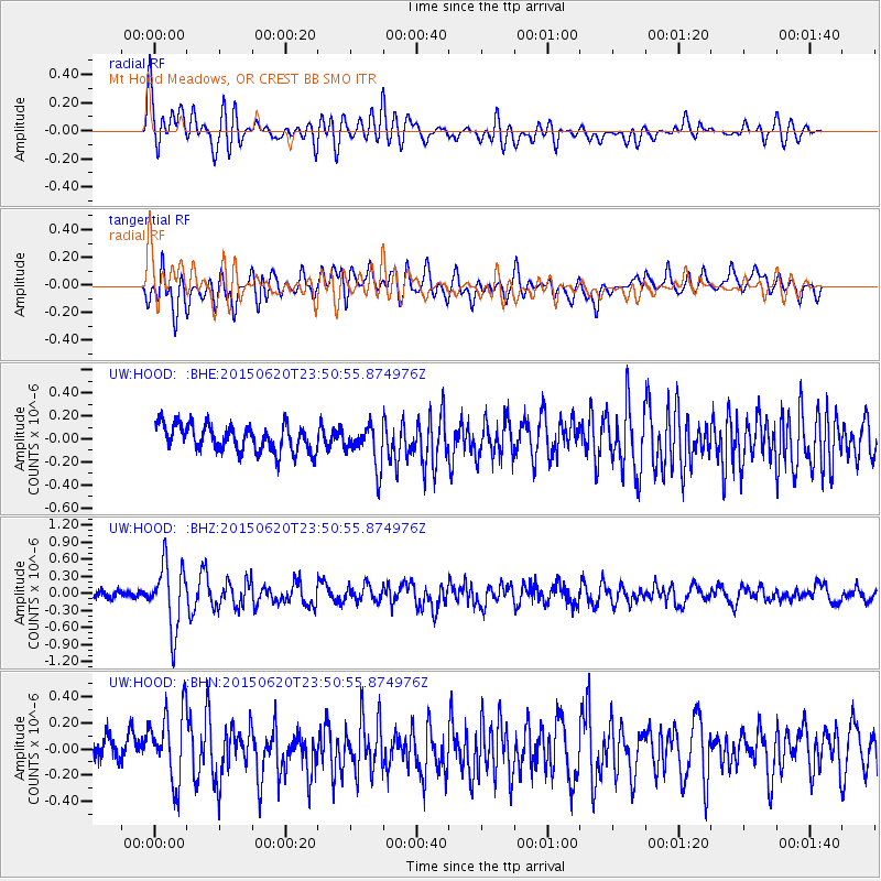
HOOD Mt Hood Meadows, OR CREST BB SMO - Earthquake Result Viewer
*The percent match for this event was below the threshold and hence no stack was calculated.
| Earthquake location: |
South Of Fiji Islands |
| Earthquake latitude/longitude: |
-23.6/-177.1 |
| Earthquake time(UTC): |
2015/06/20 (171) 23:39:09 GMT |
| Earthquake Depth: |
158 km |
| Earthquake Magnitude: |
5.9 MO |
| Earthquake Catalog/Contributor: |
NEIC PDE/NEIC ALERT |
|
| Network: |
UW Pacific Northwest Regional Seismic Network |
| Station: |
HOOD Mt Hood Meadows, OR CREST BB SMO |
| Lat/Lon: |
45.32 N/121.65 W |
| Elevation: |
1520 m |
|
| Distance: |
85.1 deg |
| Az: |
35.676 deg |
| Baz: |
229.334 deg |
| Ray Param: |
$rayparam |
*The percent match for this event was below the threshold and hence was not used in the summary stack. |
|
| Radial Match: |
72.39148 % |
| Radial Bump: |
400 |
| Transverse Match: |
73.43323 % |
| Transverse Bump: |
400 |
| SOD ConfigId: |
7422571 |
| Insert Time: |
2019-04-19 10:12:10.952 +0000 |
| GWidth: |
2.5 |
| Max Bumps: |
400 |
| Tol: |
0.001 |
|
Signal To Noise
| Channel | StoN | STA | LTA |
| UW:HOOD: :BHZ:20150620T23:50:55.874976Z | 7.208964 | 5.627992E-7 | 7.8069355E-8 |
| UW:HOOD: :BHN:20150620T23:50:55.874976Z | 3.655058 | 2.8291637E-7 | 7.7404074E-8 |
| UW:HOOD: :BHE:20150620T23:50:55.874976Z | 1.5981817 | 1.8499355E-7 | 1.1575251E-7 |
| Arrivals |
| Ps | |
| PpPs | |
| PsPs/PpSs | |


