You are here: Home > Network List > US - United States National Seismic Network Stations List
> Station HAWA Hanford, Washington, USA > Earthquake Result Viewer
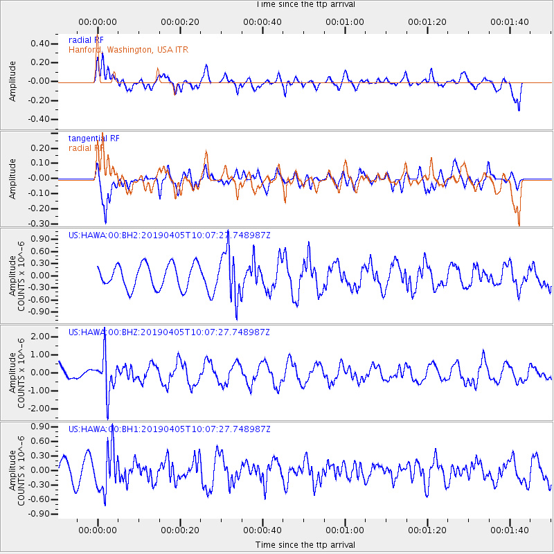
HAWA Hanford, Washington, USA - Earthquake Result Viewer
*The percent match for this event was below the threshold and hence no stack was calculated.
| Earthquake location: |
Southeast Of Honshu, Japan |
| Earthquake latitude/longitude: |
30.4/138.6 |
| Earthquake time(UTC): |
2019/04/05 (095) 09:56:53 GMT |
| Earthquake Depth: |
389 km |
| Earthquake Magnitude: |
5.8 Mww |
| Earthquake Catalog/Contributor: |
NEIC PDE/us |
|
| Network: |
US United States National Seismic Network |
| Station: |
HAWA Hanford, Washington, USA |
| Lat/Lon: |
46.39 N/119.53 W |
| Elevation: |
364 m |
|
| Distance: |
76.0 deg |
| Az: |
44.273 deg |
| Baz: |
299.429 deg |
| Ray Param: |
$rayparam |
*The percent match for this event was below the threshold and hence was not used in the summary stack. |
|
| Radial Match: |
65.84347 % |
| Radial Bump: |
400 |
| Transverse Match: |
80.95197 % |
| Transverse Bump: |
400 |
| SOD ConfigId: |
8726151 |
| Insert Time: |
2019-04-19 10:15:15.381 +0000 |
| GWidth: |
2.5 |
| Max Bumps: |
400 |
| Tol: |
0.001 |
|
Signal To Noise
| Channel | StoN | STA | LTA |
| US:HAWA:00:BHZ:20190405T10:07:27.748987Z | 1.9275407 | 1.0310023E-6 | 5.348797E-7 |
| US:HAWA:00:BH1:20190405T10:07:27.748987Z | 1.4667566 | 4.3924607E-7 | 2.994676E-7 |
| US:HAWA:00:BH2:20190405T10:07:27.748987Z | 1.9820895 | 5.7818175E-7 | 2.9170315E-7 |
| Arrivals |
| Ps | |
| PpPs | |
| PsPs/PpSs | |


