You are here: Home > Network List > GS - US Geological Survey Networks Stations List
> Station DEC06 Boomer, Decatur, IL, USA > Earthquake Result Viewer
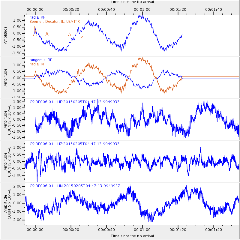
DEC06 Boomer, Decatur, IL, USA - Earthquake Result Viewer
*The percent match for this event was below the threshold and hence no stack was calculated.
| Earthquake location: |
South Of Panama |
| Earthquake latitude/longitude: |
5.2/-82.6 |
| Earthquake time(UTC): |
2015/02/05 (036) 04:40:52 GMT |
| Earthquake Depth: |
10 km |
| Earthquake Magnitude: |
5.7 MWW, 5.7 MWC |
| Earthquake Catalog/Contributor: |
NEIC PDE/NEIC COMCAT |
|
| Network: |
GS US Geological Survey Networks |
| Station: |
DEC06 Boomer, Decatur, IL, USA |
| Lat/Lon: |
39.90 N/88.95 W |
| Elevation: |
215 m |
|
| Distance: |
35.0 deg |
| Az: |
351.499 deg |
| Baz: |
168.967 deg |
| Ray Param: |
$rayparam |
*The percent match for this event was below the threshold and hence was not used in the summary stack. |
|
| Radial Match: |
68.27009 % |
| Radial Bump: |
400 |
| Transverse Match: |
68.54147 % |
| Transverse Bump: |
400 |
| SOD ConfigId: |
872571 |
| Insert Time: |
2015-02-19 05:05:54.756 +0000 |
| GWidth: |
2.5 |
| Max Bumps: |
400 |
| Tol: |
0.001 |
|
Signal To Noise
| Channel | StoN | STA | LTA |
| GS:DEC06:01:HHZ:20150205T04:47:13.994993Z | 2.349731 | 5.5012214E-7 | 2.3412133E-7 |
| GS:DEC06:01:HHN:20150205T04:47:13.994993Z | 2.4358656 | 1.6388266E-6 | 6.727902E-7 |
| GS:DEC06:01:HHE:20150205T04:47:13.994993Z | 2.121319 | 1.1114013E-6 | 5.2391994E-7 |
| Arrivals |
| Ps | |
| PpPs | |
| PsPs/PpSs | |


