You are here: Home > Network List > IU - Global Seismograph Network (GSN - IRIS/USGS) Stations List
> Station MA2 Magadan, Russia > Earthquake Result Viewer
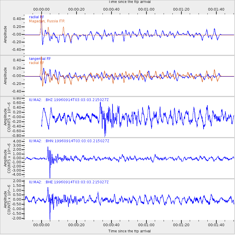
MA2 Magadan, Russia - Earthquake Result Viewer
*The percent match for this event was below the threshold and hence no stack was calculated.
| Earthquake location: |
Minahassa Peninsula, Sulawesi |
| Earthquake latitude/longitude: |
-0.0/122.8 |
| Earthquake time(UTC): |
1996/09/14 (258) 02:53:24 GMT |
| Earthquake Depth: |
181 km |
| Earthquake Magnitude: |
5.5 MB |
| Earthquake Catalog/Contributor: |
WHDF/NEIC |
|
| Network: |
IU Global Seismograph Network (GSN - IRIS/USGS) |
| Station: |
MA2 Magadan, Russia |
| Lat/Lon: |
59.58 N/150.77 E |
| Elevation: |
339 m |
|
| Distance: |
63.3 deg |
| Az: |
15.5 deg |
| Baz: |
211.674 deg |
| Ray Param: |
$rayparam |
*The percent match for this event was below the threshold and hence was not used in the summary stack. |
|
| Radial Match: |
73.783295 % |
| Radial Bump: |
400 |
| Transverse Match: |
62.745266 % |
| Transverse Bump: |
400 |
| SOD ConfigId: |
4480 |
| Insert Time: |
2010-03-03 15:02:10.529 +0000 |
| GWidth: |
2.5 |
| Max Bumps: |
400 |
| Tol: |
0.001 |
|
Signal To Noise
| Channel | StoN | STA | LTA |
| IU:MA2: :BHN:19960914T03:03:03.215027Z | 6.124489 | 1.090286E-6 | 1.7802071E-7 |
| IU:MA2: :BHE:19960914T03:03:03.215027Z | 2.7461185 | 5.018998E-7 | 1.82767E-7 |
| IU:MA2: :BHZ:19960914T03:03:03.215027Z | 1.366866 | 2.2887511E-7 | 1.6744517E-7 |
| Arrivals |
| Ps | |
| PpPs | |
| PsPs/PpSs | |


