You are here: Home > Network List > CN - Canadian National Seismograph Network Stations List
> Station INK INUVIK, NT > Earthquake Result Viewer
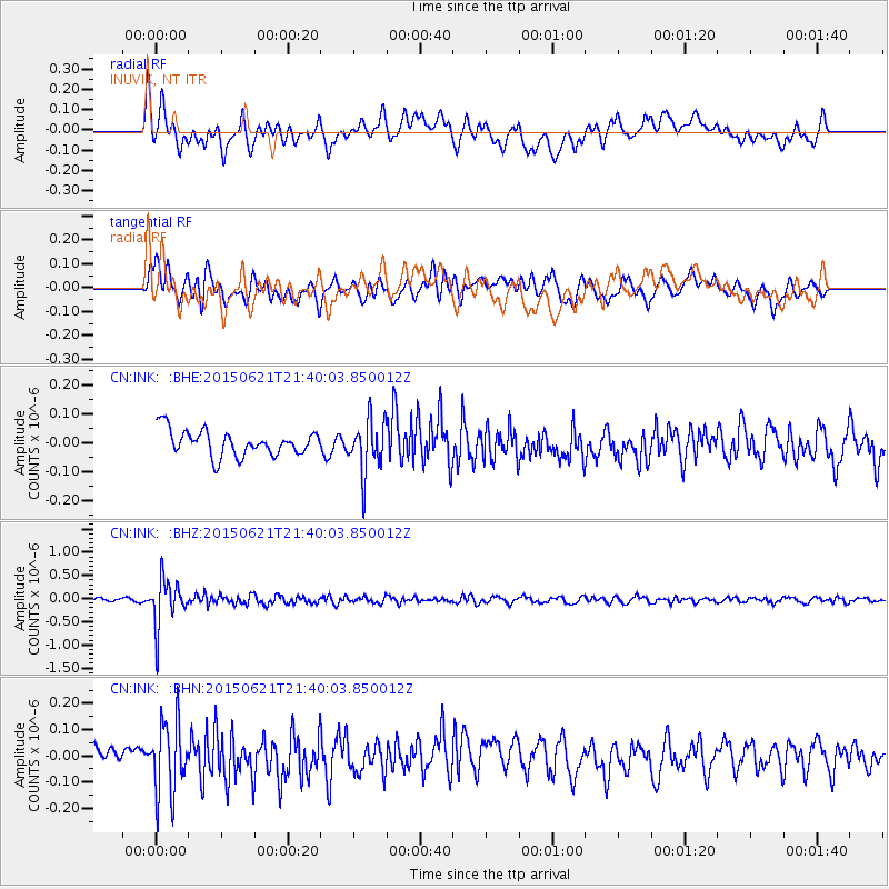
INK INUVIK, NT - Earthquake Result Viewer
*The percent match for this event was below the threshold and hence no stack was calculated.
| Earthquake location: |
Fiji Islands Region |
| Earthquake latitude/longitude: |
-20.5/-178.4 |
| Earthquake time(UTC): |
2015/06/21 (172) 21:28:16 GMT |
| Earthquake Depth: |
563 km |
| Earthquake Magnitude: |
6.5 MO |
| Earthquake Catalog/Contributor: |
NEIC PDE/NEIC ALERT |
|
| Network: |
CN Canadian National Seismograph Network |
| Station: |
INK INUVIK, NT |
| Lat/Lon: |
68.31 N/133.53 W |
| Elevation: |
44 m |
|
| Distance: |
94.3 deg |
| Az: |
15.238 deg |
| Baz: |
221.523 deg |
| Ray Param: |
$rayparam |
*The percent match for this event was below the threshold and hence was not used in the summary stack. |
|
| Radial Match: |
70.98733 % |
| Radial Bump: |
400 |
| Transverse Match: |
59.419506 % |
| Transverse Bump: |
400 |
| SOD ConfigId: |
7422571 |
| Insert Time: |
2019-04-19 10:17:56.510 +0000 |
| GWidth: |
2.5 |
| Max Bumps: |
400 |
| Tol: |
0.001 |
|
Signal To Noise
| Channel | StoN | STA | LTA |
| CN:INK: :BHZ:20150621T21:40:03.850012Z | 12.50241 | 5.0037085E-7 | 4.0021952E-8 |
| CN:INK: :BHN:20150621T21:40:03.850012Z | 4.2641606 | 1.3709693E-7 | 3.215098E-8 |
| CN:INK: :BHE:20150621T21:40:03.850012Z | 2.5937219 | 1.0441315E-7 | 4.0256108E-8 |
| Arrivals |
| Ps | |
| PpPs | |
| PsPs/PpSs | |


