You are here: Home > Network List > TA - USArray Transportable Network (new EarthScope stations) Stations List
> Station G05D Wamic, OR, USA > Earthquake Result Viewer
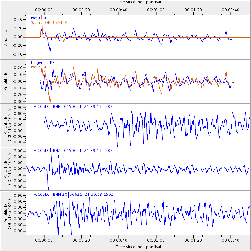
G05D Wamic, OR, USA - Earthquake Result Viewer
*The percent match for this event was below the threshold and hence no stack was calculated.
| Earthquake location: |
Fiji Islands Region |
| Earthquake latitude/longitude: |
-20.5/-178.4 |
| Earthquake time(UTC): |
2015/06/21 (172) 21:28:16 GMT |
| Earthquake Depth: |
563 km |
| Earthquake Magnitude: |
6.5 MO |
| Earthquake Catalog/Contributor: |
NEIC PDE/NEIC ALERT |
|
| Network: |
TA USArray Transportable Network (new EarthScope stations) |
| Station: |
G05D Wamic, OR, USA |
| Lat/Lon: |
45.24 N/121.32 W |
| Elevation: |
592 m |
|
| Distance: |
83.4 deg |
| Az: |
36.632 deg |
| Baz: |
232.369 deg |
| Ray Param: |
$rayparam |
*The percent match for this event was below the threshold and hence was not used in the summary stack. |
|
| Radial Match: |
61.308502 % |
| Radial Bump: |
400 |
| Transverse Match: |
59.425747 % |
| Transverse Bump: |
400 |
| SOD ConfigId: |
7422571 |
| Insert Time: |
2019-04-19 10:20:25.401 +0000 |
| GWidth: |
2.5 |
| Max Bumps: |
400 |
| Tol: |
0.001 |
|
Signal To Noise
| Channel | StoN | STA | LTA |
| TA:G05D: :BHZ:20150621T21:39:13.150Z | 5.9558597 | 1.5800047E-6 | 2.6528576E-7 |
| TA:G05D: :BHN:20150621T21:39:13.150Z | 1.276764 | 2.1290205E-7 | 1.6675129E-7 |
| TA:G05D: :BHE:20150621T21:39:13.150Z | 1.520429 | 2.737563E-7 | 1.8005201E-7 |
| Arrivals |
| Ps | |
| PpPs | |
| PsPs/PpSs | |


