You are here: Home > Network List > CI - Caltech Regional Seismic Network Stations List
> Station MPM Manuel Prospect Mine, California, USA > Earthquake Result Viewer
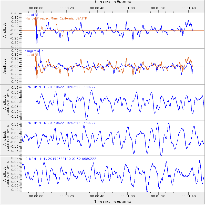
MPM Manuel Prospect Mine, California, USA - Earthquake Result Viewer
*The percent match for this event was below the threshold and hence no stack was calculated.
| Earthquake location: |
Southeast Of Loyalty Islands |
| Earthquake latitude/longitude: |
-22.7/174.0 |
| Earthquake time(UTC): |
2015/06/22 (173) 09:50:40 GMT |
| Earthquake Depth: |
35 km |
| Earthquake Magnitude: |
3.9 mb |
| Earthquake Catalog/Contributor: |
ISC/ISC |
|
| Network: |
CI Caltech Regional Seismic Network |
| Station: |
MPM Manuel Prospect Mine, California, USA |
| Lat/Lon: |
36.06 N/117.49 W |
| Elevation: |
185 m |
|
| Distance: |
87.2 deg |
| Az: |
49.031 deg |
| Baz: |
239.393 deg |
| Ray Param: |
$rayparam |
*The percent match for this event was below the threshold and hence was not used in the summary stack. |
|
| Radial Match: |
54.847717 % |
| Radial Bump: |
400 |
| Transverse Match: |
59.458424 % |
| Transverse Bump: |
354 |
| SOD ConfigId: |
7422571 |
| Insert Time: |
2019-04-19 10:25:48.213 +0000 |
| GWidth: |
2.5 |
| Max Bumps: |
400 |
| Tol: |
0.001 |
|
Signal To Noise
| Channel | StoN | STA | LTA |
| CI:MPM: :HHZ:20150622T10:02:52.068022Z | 1.5480379 | 5.8781097E-8 | 3.7971358E-8 |
| CI:MPM: :HHN:20150622T10:02:52.068022Z | 1.0004848 | 5.4003284E-8 | 5.397711E-8 |
| CI:MPM: :HHE:20150622T10:02:52.068022Z | 1.6575688 | 9.3929366E-8 | 5.666695E-8 |
| Arrivals |
| Ps | |
| PpPs | |
| PsPs/PpSs | |


