You are here: Home > Network List > TA - USArray Transportable Network (new EarthScope stations) Stations List
> Station R11A Troy Canyon, Currant, NV, USA > Earthquake Result Viewer
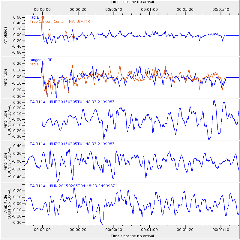
R11A Troy Canyon, Currant, NV, USA - Earthquake Result Viewer
*The percent match for this event was below the threshold and hence no stack was calculated.
| Earthquake location: |
South Of Panama |
| Earthquake latitude/longitude: |
5.2/-82.6 |
| Earthquake time(UTC): |
2015/02/05 (036) 04:40:52 GMT |
| Earthquake Depth: |
10 km |
| Earthquake Magnitude: |
5.7 MWW, 5.7 MWC |
| Earthquake Catalog/Contributor: |
NEIC PDE/NEIC COMCAT |
|
| Network: |
TA USArray Transportable Network (new EarthScope stations) |
| Station: |
R11A Troy Canyon, Currant, NV, USA |
| Lat/Lon: |
38.35 N/115.59 W |
| Elevation: |
1756 m |
|
| Distance: |
44.5 deg |
| Az: |
322.406 deg |
| Baz: |
129.401 deg |
| Ray Param: |
$rayparam |
*The percent match for this event was below the threshold and hence was not used in the summary stack. |
|
| Radial Match: |
55.789917 % |
| Radial Bump: |
400 |
| Transverse Match: |
60.03546 % |
| Transverse Bump: |
400 |
| SOD ConfigId: |
872571 |
| Insert Time: |
2015-02-19 05:27:53.840 +0000 |
| GWidth: |
2.5 |
| Max Bumps: |
400 |
| Tol: |
0.001 |
|
Signal To Noise
| Channel | StoN | STA | LTA |
| TA:R11A: :BHZ:20150205T04:48:33.249998Z | 1.2082956 | 1.6267037E-7 | 1.3462797E-7 |
| TA:R11A: :BHN:20150205T04:48:33.249998Z | 0.90274143 | 9.464948E-8 | 1.0484672E-7 |
| TA:R11A: :BHE:20150205T04:48:33.249998Z | 1.9497966 | 1.5664268E-7 | 8.033796E-8 |
| Arrivals |
| Ps | |
| PpPs | |
| PsPs/PpSs | |


