You are here: Home > Network List > CI - Caltech Regional Seismic Network Stations List
> Station MPM Manuel Prospect Mine, California, USA > Earthquake Result Viewer
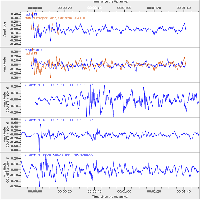
MPM Manuel Prospect Mine, California, USA - Earthquake Result Viewer
*The percent match for this event was below the threshold and hence no stack was calculated.
| Earthquake location: |
Tonga Islands |
| Earthquake latitude/longitude: |
-19.7/-175.2 |
| Earthquake time(UTC): |
2015/06/23 (174) 08:59:54 GMT |
| Earthquake Depth: |
124 km |
| Earthquake Magnitude: |
5.6 MB |
| Earthquake Catalog/Contributor: |
NEIC PDE/NEIC ALERT |
|
| Network: |
CI Caltech Regional Seismic Network |
| Station: |
MPM Manuel Prospect Mine, California, USA |
| Lat/Lon: |
36.06 N/117.49 W |
| Elevation: |
185 m |
|
| Distance: |
77.8 deg |
| Az: |
44.506 deg |
| Baz: |
234.615 deg |
| Ray Param: |
$rayparam |
*The percent match for this event was below the threshold and hence was not used in the summary stack. |
|
| Radial Match: |
79.06969 % |
| Radial Bump: |
400 |
| Transverse Match: |
44.319378 % |
| Transverse Bump: |
400 |
| SOD ConfigId: |
7422571 |
| Insert Time: |
2019-04-19 10:31:52.708 +0000 |
| GWidth: |
2.5 |
| Max Bumps: |
400 |
| Tol: |
0.001 |
|
Signal To Noise
| Channel | StoN | STA | LTA |
| CI:MPM: :HHZ:20150623T09:11:05.428027Z | 2.7669759 | 2.7820994E-7 | 1.0054658E-7 |
| CI:MPM: :HHN:20150623T09:11:05.428027Z | 1.4228791 | 1.16853364E-7 | 8.2124586E-8 |
| CI:MPM: :HHE:20150623T09:11:05.428027Z | 2.047534 | 9.239711E-8 | 4.5126047E-8 |
| Arrivals |
| Ps | |
| PpPs | |
| PsPs/PpSs | |


