You are here: Home > Network List > TA - USArray Transportable Network (new EarthScope stations) Stations List
> Station J04D Umpqua National Forest, Toketee, OR, USA > Earthquake Result Viewer
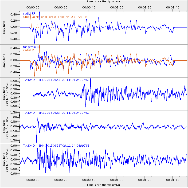
J04D Umpqua National Forest, Toketee, OR, USA - Earthquake Result Viewer
*The percent match for this event was below the threshold and hence no stack was calculated.
| Earthquake location: |
Tonga Islands |
| Earthquake latitude/longitude: |
-19.7/-175.2 |
| Earthquake time(UTC): |
2015/06/23 (174) 08:59:54 GMT |
| Earthquake Depth: |
124 km |
| Earthquake Magnitude: |
5.6 MB |
| Earthquake Catalog/Contributor: |
NEIC PDE/NEIC ALERT |
|
| Network: |
TA USArray Transportable Network (new EarthScope stations) |
| Station: |
J04D Umpqua National Forest, Toketee, OR, USA |
| Lat/Lon: |
43.24 N/122.11 W |
| Elevation: |
1948 m |
|
| Distance: |
79.3 deg |
| Az: |
36.49 deg |
| Baz: |
230.078 deg |
| Ray Param: |
$rayparam |
*The percent match for this event was below the threshold and hence was not used in the summary stack. |
|
| Radial Match: |
61.164066 % |
| Radial Bump: |
400 |
| Transverse Match: |
59.161793 % |
| Transverse Bump: |
400 |
| SOD ConfigId: |
7422571 |
| Insert Time: |
2019-04-19 10:35:20.600 +0000 |
| GWidth: |
2.5 |
| Max Bumps: |
400 |
| Tol: |
0.001 |
|
Signal To Noise
| Channel | StoN | STA | LTA |
| TA:J04D: :BHZ:20150623T09:11:14.049976Z | 3.6835852 | 4.8947436E-7 | 1.3287988E-7 |
| TA:J04D: :BHN:20150623T09:11:14.049976Z | 2.1031375 | 2.8228126E-7 | 1.3421912E-7 |
| TA:J04D: :BHE:20150623T09:11:14.049976Z | 1.3594064 | 1.7219341E-7 | 1.2666808E-7 |
| Arrivals |
| Ps | |
| PpPs | |
| PsPs/PpSs | |


