You are here: Home > Network List > UW - Pacific Northwest Regional Seismic Network Stations List
> Station LCCR Mulino, OR, USA > Earthquake Result Viewer
LCCR Mulino, OR, USA - Earthquake Result Viewer
*The percent match for this event was below the threshold and hence no stack was calculated.
| Earthquake location: |
Tonga Islands |
| Earthquake latitude/longitude: |
-19.7/-175.2 |
| Earthquake time(UTC): |
2015/06/23 (174) 08:59:54 GMT |
| Earthquake Depth: |
124 km |
| Earthquake Magnitude: |
5.6 MB |
| Earthquake Catalog/Contributor: |
NEIC PDE/NEIC ALERT |
|
| Network: |
UW Pacific Northwest Regional Seismic Network |
| Station: |
LCCR Mulino, OR, USA |
| Lat/Lon: |
45.21 N/122.48 W |
| Elevation: |
273 m |
|
| Distance: |
80.4 deg |
| Az: |
34.792 deg |
| Baz: |
229.522 deg |
| Ray Param: |
$rayparam |
*The percent match for this event was below the threshold and hence was not used in the summary stack. |
|
| Radial Match: |
60.975048 % |
| Radial Bump: |
400 |
| Transverse Match: |
65.06642 % |
| Transverse Bump: |
400 |
| SOD ConfigId: |
7422571 |
| Insert Time: |
2019-04-19 10:36:35.500 +0000 |
| GWidth: |
2.5 |
| Max Bumps: |
400 |
| Tol: |
0.001 |
|
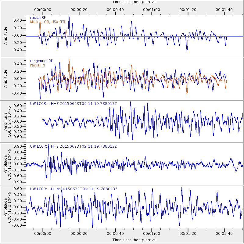
Signal To Noise
| Channel | StoN | STA | LTA |
| UW:LCCR: :HHZ:20150623T09:11:19.788013Z | 4.7470894 | 3.8240245E-7 | 8.055513E-8 |
| UW:LCCR: :HHN:20150623T09:11:19.788013Z | 1.2383612 | 1.7985197E-7 | 1.4523384E-7 |
| UW:LCCR: :HHE:20150623T09:11:19.788013Z | 1.1452122 | 1.1922053E-7 | 1.0410344E-7 |
| Arrivals |
| Ps | |
| PpPs | |
| PsPs/PpSs | |


