You are here: Home > Network List > UW - Pacific Northwest Regional Seismic Network Stations List
> Station UMAT Pilot Rock, OR, USA > Earthquake Result Viewer
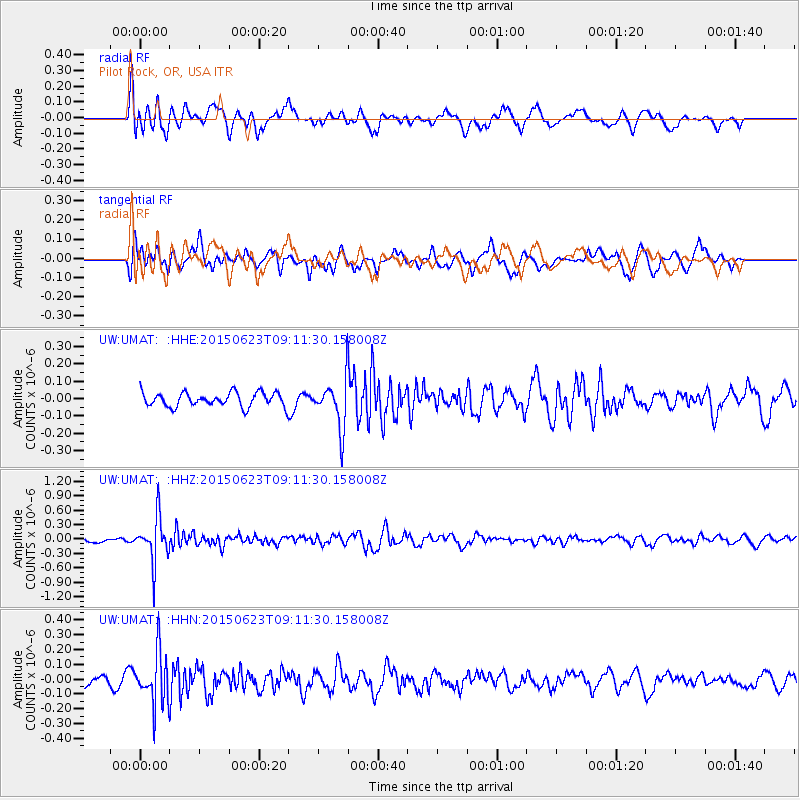
UMAT Pilot Rock, OR, USA - Earthquake Result Viewer
*The percent match for this event was below the threshold and hence no stack was calculated.
| Earthquake location: |
Tonga Islands |
| Earthquake latitude/longitude: |
-19.7/-175.2 |
| Earthquake time(UTC): |
2015/06/23 (174) 08:59:54 GMT |
| Earthquake Depth: |
124 km |
| Earthquake Magnitude: |
5.6 MB |
| Earthquake Catalog/Contributor: |
NEIC PDE/NEIC ALERT |
|
| Network: |
UW Pacific Northwest Regional Seismic Network |
| Station: |
UMAT Pilot Rock, OR, USA |
| Lat/Lon: |
45.29 N/118.96 W |
| Elevation: |
1318 m |
|
| Distance: |
82.4 deg |
| Az: |
36.312 deg |
| Baz: |
232.241 deg |
| Ray Param: |
$rayparam |
*The percent match for this event was below the threshold and hence was not used in the summary stack. |
|
| Radial Match: |
56.810604 % |
| Radial Bump: |
400 |
| Transverse Match: |
50.754856 % |
| Transverse Bump: |
400 |
| SOD ConfigId: |
7422571 |
| Insert Time: |
2019-04-19 10:36:45.044 +0000 |
| GWidth: |
2.5 |
| Max Bumps: |
400 |
| Tol: |
0.001 |
|
Signal To Noise
| Channel | StoN | STA | LTA |
| UW:UMAT: :HHZ:20150623T09:11:30.158008Z | 7.1780787 | 4.6496322E-7 | 6.477544E-8 |
| UW:UMAT: :HHN:20150623T09:11:30.158008Z | 2.8112817 | 1.729637E-7 | 6.152486E-8 |
| UW:UMAT: :HHE:20150623T09:11:30.158008Z | 3.7214153 | 1.6272189E-7 | 4.3725805E-8 |
| Arrivals |
| Ps | |
| PpPs | |
| PsPs/PpSs | |


