You are here: Home > Network List > IU - Global Seismograph Network (GSN - IRIS/USGS) Stations List
> Station MA2 Magadan, Russia > Earthquake Result Viewer
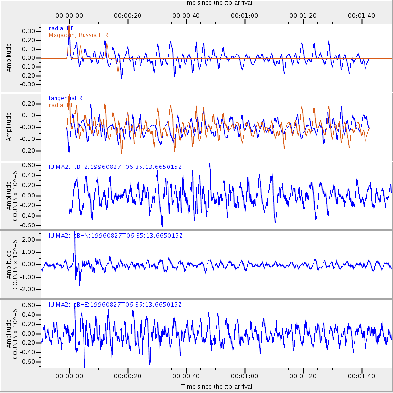
MA2 Magadan, Russia - Earthquake Result Viewer
*The percent match for this event was below the threshold and hence no stack was calculated.
| Earthquake location: |
South Of Fiji Islands |
| Earthquake latitude/longitude: |
-22.6/-179.8 |
| Earthquake time(UTC): |
1996/08/27 (240) 06:24:07 GMT |
| Earthquake Depth: |
575 km |
| Earthquake Magnitude: |
5.6 MB, 6.0 UNKNOWN, 5.5 MB |
| Earthquake Catalog/Contributor: |
WHDF/NEIC |
|
| Network: |
IU Global Seismograph Network (GSN - IRIS/USGS) |
| Station: |
MA2 Magadan, Russia |
| Lat/Lon: |
59.58 N/150.77 E |
| Elevation: |
339 m |
|
| Distance: |
85.3 deg |
| Az: |
345.466 deg |
| Baz: |
152.884 deg |
| Ray Param: |
$rayparam |
*The percent match for this event was below the threshold and hence was not used in the summary stack. |
|
| Radial Match: |
63.957264 % |
| Radial Bump: |
400 |
| Transverse Match: |
55.393913 % |
| Transverse Bump: |
400 |
| SOD ConfigId: |
4480 |
| Insert Time: |
2010-03-03 15:05:16.362 +0000 |
| GWidth: |
2.5 |
| Max Bumps: |
400 |
| Tol: |
0.001 |
|
Signal To Noise
| Channel | StoN | STA | LTA |
| IU:MA2: :BHN:19960827T06:35:13.665015Z | 4.070069 | 7.800061E-7 | 1.9164445E-7 |
| IU:MA2: :BHE:19960827T06:35:13.665015Z | 1.4526803 | 2.522206E-7 | 1.7362429E-7 |
| IU:MA2: :BHZ:19960827T06:35:13.665015Z | 1.4767454 | 2.7558045E-7 | 1.8661338E-7 |
| Arrivals |
| Ps | |
| PpPs | |
| PsPs/PpSs | |


