
HRV Harvard, Massachusetts, USA - Earthquake Result Viewer
| ||||||||||||||||||
| ||||||||||||||||||
| ||||||||||||||||||
|
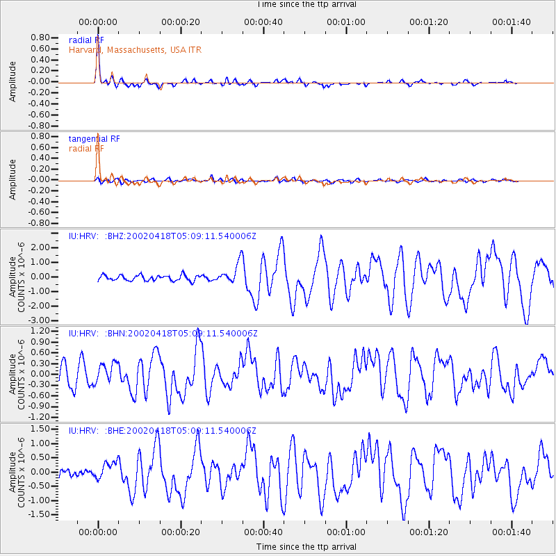
Signal To Noise
| Channel | StoN | STA | LTA |
| IU:HRV: :BHN:20020418T05:09:11.540006Z | 1.4541744 | 2.8977684E-7 | 1.9927242E-7 |
| IU:HRV: :BHE:20020418T05:09:11.540006Z | 3.2127278 | 3.1619493E-7 | 9.841946E-8 |
| IU:HRV: :BHZ:20020418T05:09:11.540006Z | 4.120376 | 7.725183E-7 | 1.8748733E-7 |
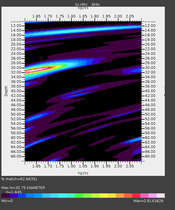
| Arrivals | |
| Ps | 3.4 SECOND |
| PpPs | 12 SECOND |
| PsPs/PpSs | 15 SECOND |

