You are here: Home > Network List > BK - Berkeley Digital Seismograph Network Stations List
> Station HUMO Hull Mountain, OR > Earthquake Result Viewer
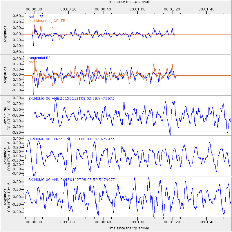
HUMO Hull Mountain, OR - Earthquake Result Viewer
*The percent match for this event was below the threshold and hence no stack was calculated.
| Earthquake location: |
Near Coast Of Chiapas, Mexico |
| Earthquake latitude/longitude: |
15.5/-93.4 |
| Earthquake time(UTC): |
2015/01/12 (012) 07:57:27 GMT |
| Earthquake Depth: |
75 km |
| Earthquake Magnitude: |
5.5 MWW, 5.5 MWC, 5.5 MWB |
| Earthquake Catalog/Contributor: |
NEIC PDE/NEIC COMCAT |
|
| Network: |
BK Berkeley Digital Seismograph Network |
| Station: |
HUMO Hull Mountain, OR |
| Lat/Lon: |
42.61 N/122.96 W |
| Elevation: |
555 m |
|
| Distance: |
37.1 deg |
| Az: |
322.801 deg |
| Baz: |
127.851 deg |
| Ray Param: |
$rayparam |
*The percent match for this event was below the threshold and hence was not used in the summary stack. |
|
| Radial Match: |
52.736496 % |
| Radial Bump: |
400 |
| Transverse Match: |
56.93985 % |
| Transverse Bump: |
400 |
| SOD ConfigId: |
872571 |
| Insert Time: |
2015-02-19 08:58:05.333 +0000 |
| GWidth: |
2.5 |
| Max Bumps: |
400 |
| Tol: |
0.001 |
|
Signal To Noise
| Channel | StoN | STA | LTA |
| BK:HUMO:00:HHZ:20150112T08:03:59.547997Z | 1.6790298 | 2.9955518E-7 | 1.7840969E-7 |
| BK:HUMO:00:HHN:20150112T08:03:59.547997Z | 0.5769506 | 7.0946776E-8 | 1.2296854E-7 |
| BK:HUMO:00:HHE:20150112T08:03:59.547997Z | 0.6269039 | 5.3864404E-8 | 8.592131E-8 |
| Arrivals |
| Ps | |
| PpPs | |
| PsPs/PpSs | |


