
HRV Harvard, Massachusetts, USA - Earthquake Result Viewer
| ||||||||||||||||||
| ||||||||||||||||||
| ||||||||||||||||||
|
Signal To Noise
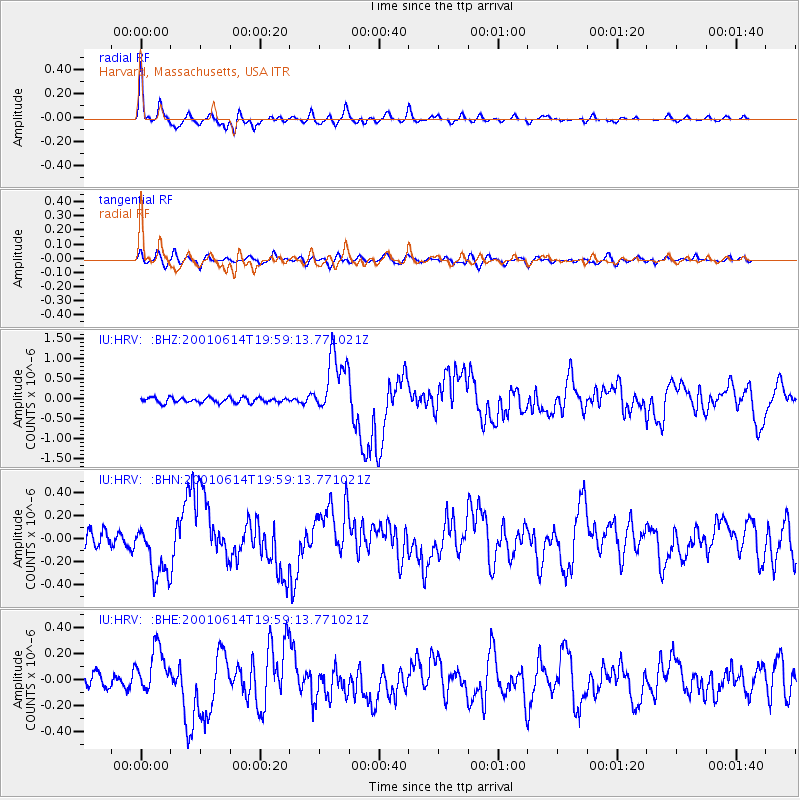
| Channel | StoN | STA | LTA |
| IU:HRV: :BHN:20010614T19:59:13.771021Z | 3.619609 | 2.4419245E-7 | 6.746376E-8 |
| IU:HRV: :BHE:20010614T19:59:13.771021Z | 2.021208 | 1.7750017E-7 | 8.781885E-8 |
| IU:HRV: :BHZ:20010614T19:59:13.771021Z | 12.362972 | 7.7190566E-7 | 6.24369E-8 |
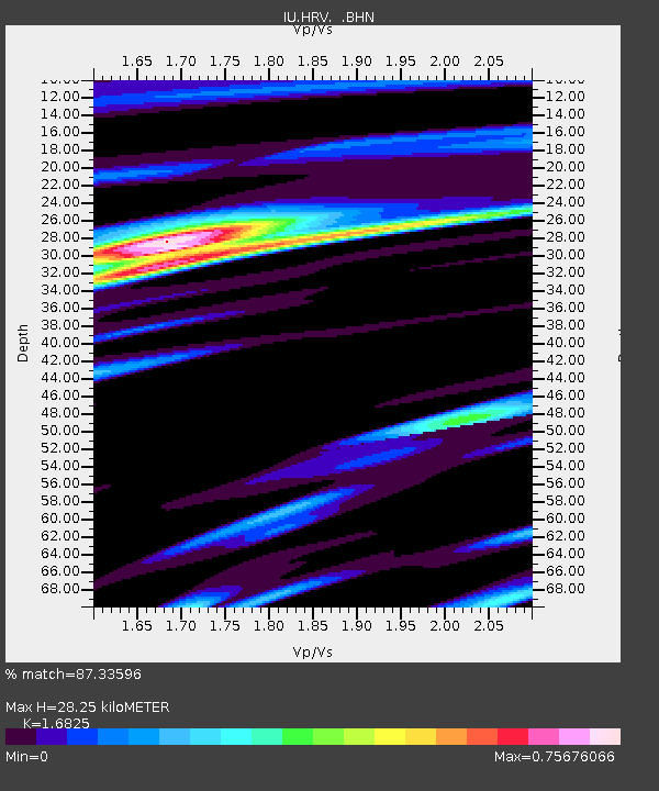
| Arrivals | |
| Ps | 3.1 SECOND |
| PpPs | 11 SECOND |
| PsPs/PpSs | 14 SECOND |

