
HRV Harvard, Massachusetts, USA - Earthquake Result Viewer
| ||||||||||||||||||
| ||||||||||||||||||
| ||||||||||||||||||
|
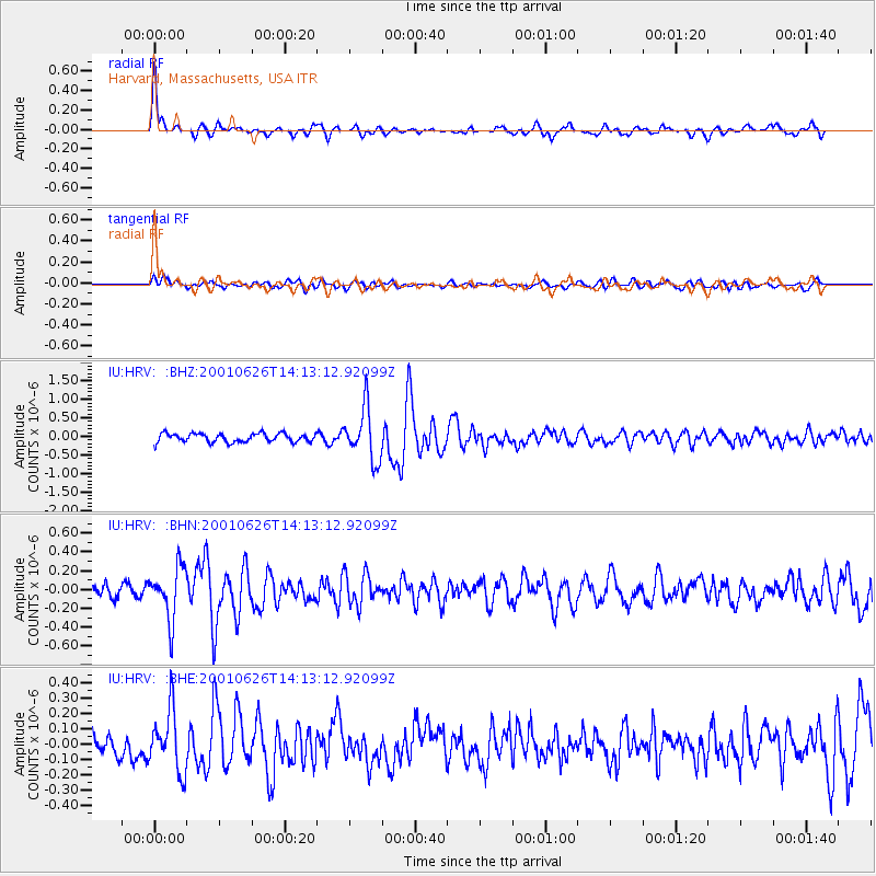
Signal To Noise
| Channel | StoN | STA | LTA |
| IU:HRV: :BHN:20010626T14:13:12.92099Z | 4.1329327 | 2.7802935E-7 | 6.7271685E-8 |
| IU:HRV: :BHE:20010626T14:13:12.92099Z | 2.3190439 | 1.9818029E-7 | 8.5457756E-8 |
| IU:HRV: :BHZ:20010626T14:13:12.92099Z | 5.964063 | 6.990394E-7 | 1.17208586E-7 |
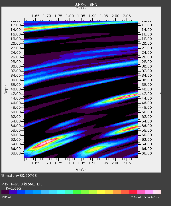
| Arrivals | |
| Ps | 7.3 SECOND |
| PpPs | 25 SECOND |
| PsPs/PpSs | 32 SECOND |

