You are here: Home > Network List > TA - USArray Transportable Network (new EarthScope stations) Stations List
> Station G57A Newington, ON, CAN > Earthquake Result Viewer
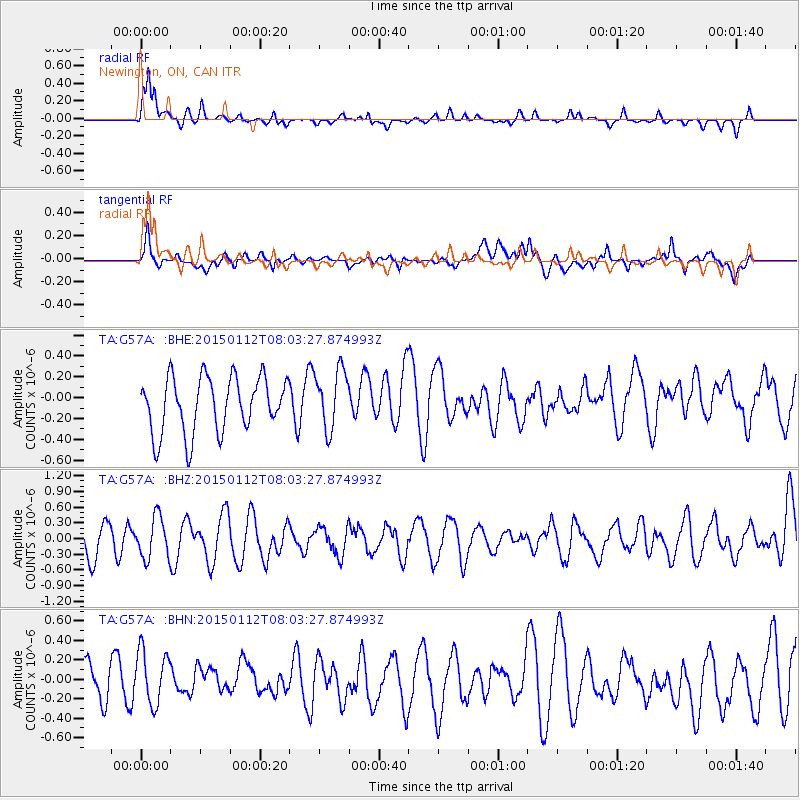
G57A Newington, ON, CAN - Earthquake Result Viewer
*The percent match for this event was below the threshold and hence no stack was calculated.
| Earthquake location: |
Near Coast Of Chiapas, Mexico |
| Earthquake latitude/longitude: |
15.5/-93.4 |
| Earthquake time(UTC): |
2015/01/12 (012) 07:57:27 GMT |
| Earthquake Depth: |
75 km |
| Earthquake Magnitude: |
5.5 MWW, 5.5 MWC, 5.5 MWB |
| Earthquake Catalog/Contributor: |
NEIC PDE/NEIC COMCAT |
|
| Network: |
TA USArray Transportable Network (new EarthScope stations) |
| Station: |
G57A Newington, ON, CAN |
| Lat/Lon: |
45.10 N/74.99 W |
| Elevation: |
96 m |
|
| Distance: |
33.4 deg |
| Az: |
23.976 deg |
| Baz: |
213.59 deg |
| Ray Param: |
$rayparam |
*The percent match for this event was below the threshold and hence was not used in the summary stack. |
|
| Radial Match: |
69.60607 % |
| Radial Bump: |
400 |
| Transverse Match: |
54.88021 % |
| Transverse Bump: |
400 |
| SOD ConfigId: |
872571 |
| Insert Time: |
2015-02-19 09:11:39.460 +0000 |
| GWidth: |
2.5 |
| Max Bumps: |
400 |
| Tol: |
0.001 |
|
Signal To Noise
| Channel | StoN | STA | LTA |
| TA:G57A: :BHZ:20150112T08:03:27.874993Z | 0.9578601 | 3.9060717E-7 | 4.0779145E-7 |
| TA:G57A: :BHN:20150112T08:03:27.874993Z | 1.7204332 | 2.7254057E-7 | 1.5841391E-7 |
| TA:G57A: :BHE:20150112T08:03:27.874993Z | 1.0838655 | 2.8710068E-7 | 2.6488587E-7 |
| Arrivals |
| Ps | |
| PpPs | |
| PsPs/PpSs | |


