You are here: Home > Network List > UW - Pacific Northwest Regional Seismic Network Stations List
> Station PASS Maple Falls, WA, USA > Earthquake Result Viewer
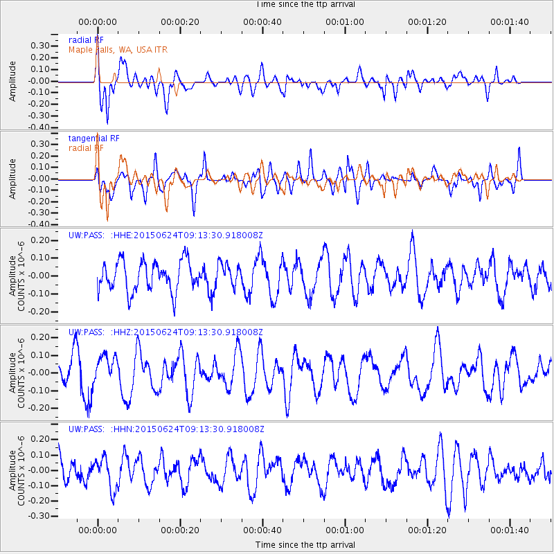
PASS Maple Falls, WA, USA - Earthquake Result Viewer
*The percent match for this event was below the threshold and hence no stack was calculated.
| Earthquake location: |
South Of Kermadec Islands |
| Earthquake latitude/longitude: |
-32.3/-178.0 |
| Earthquake time(UTC): |
2015/06/24 (175) 09:00:41 GMT |
| Earthquake Depth: |
20 km |
| Earthquake Magnitude: |
5.0 mb, 5.0 mb, 4.2 MS |
| Earthquake Catalog/Contributor: |
ISC/ISC |
|
| Network: |
UW Pacific Northwest Regional Seismic Network |
| Station: |
PASS Maple Falls, WA, USA |
| Lat/Lon: |
49.00 N/122.09 W |
| Elevation: |
174 m |
|
| Distance: |
95.0 deg |
| Az: |
33.178 deg |
| Baz: |
224.726 deg |
| Ray Param: |
$rayparam |
*The percent match for this event was below the threshold and hence was not used in the summary stack. |
|
| Radial Match: |
56.03259 % |
| Radial Bump: |
400 |
| Transverse Match: |
50.01082 % |
| Transverse Bump: |
400 |
| SOD ConfigId: |
7422571 |
| Insert Time: |
2019-04-19 11:04:00.040 +0000 |
| GWidth: |
2.5 |
| Max Bumps: |
400 |
| Tol: |
0.001 |
|
Signal To Noise
| Channel | StoN | STA | LTA |
| UW:PASS: :HHZ:20150624T09:13:30.918008Z | 0.73360413 | 8.073389E-8 | 1.1005103E-7 |
| UW:PASS: :HHN:20150624T09:13:30.918008Z | 1.1689728 | 1.04990484E-7 | 8.981431E-8 |
| UW:PASS: :HHE:20150624T09:13:30.918008Z | 0.7344881 | 6.120859E-8 | 8.3335024E-8 |
| Arrivals |
| Ps | |
| PpPs | |
| PsPs/PpSs | |


