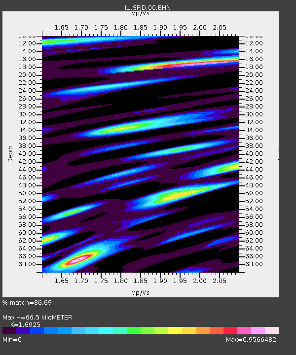
SFJD Sondre Stromfjord, Greenland - Earthquake Result Viewer
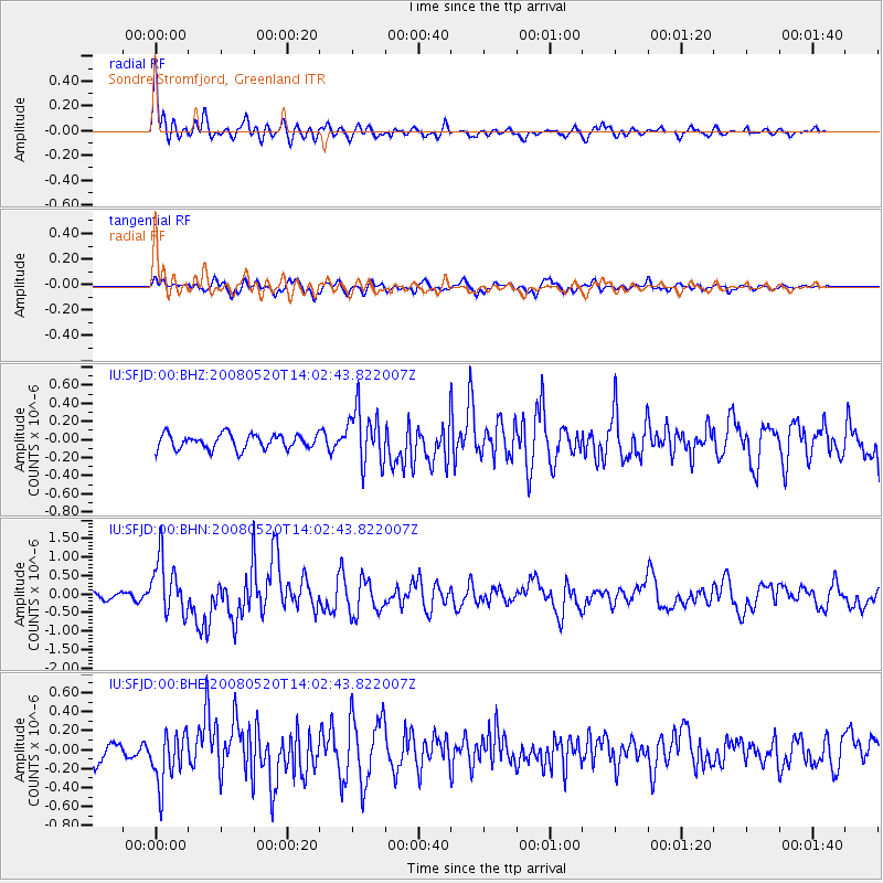
Earthquake location: Rat Islands, Aleutian Islands
Earthquake latitude/longitude: 51.2/178.8
Earthquake time(UTC): 2008/05/20 (141) 13:53:35 GMT
Earthquake Depth: 27 km
Earthquake Magnitude: 5.8 MB, 6.0 MS, 6.3 MW, 6.3 MW
Earthquake Catalog/Contributor: WHDF/NEIC
Network: IU Global Seismograph Network (GSN - IRIS/USGS)
Station: SFJD Sondre Stromfjord, Greenland
Lat/Lon: 67.00 N/50.62 W
Elevation: 328 m
Distance: 56.4 deg
Az: 20.985 deg
Baz: 324.988 deg
Ray Param: 0.06411689
Estimated Moho Depth: 66.5 km
Estimated Crust Vp/Vs: 1.69
Assumed Crust Vp: 6.459 km/s
Estimated Crust Vs: 3.817 km/s
Estimated Crust Poisson's Ratio: 0.23
Radial Match: 86.69 %
Radial Bump: 400
Transverse Match: 71.21694 %
Transverse Bump: 400
SOD ConfigId: 2504
Insert Time: 2010-03-03 15:08:35.120 +0000
GWidth: 2.5
Max Bumps: 400
Tol: 0.001

Signal To Noise

ChannelStoNSTALTA
IU:SFJD:00:BHN:20080520T14:02:43.822007Z4.3555377.3877067E-71.6961644E-7
IU:SFJD:00:BHE:20080520T14:02:43.822007Z2.82630372.709365E-79.58625E-8
IU:SFJD:00:BHZ:20080520T14:02:43.822007Z3.73364283.0258698E-78.104337E-8
Arrivals
Ps7.5 SECOND
PpPs26 SECOND
PsPs/PpSs34 SECOND