You are here: Home > Network List > TA - USArray Transportable Network (new EarthScope stations) Stations List
> Station MDND Maddock, ND, USA > Earthquake Result Viewer
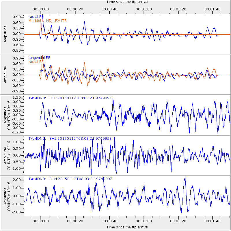
MDND Maddock, ND, USA - Earthquake Result Viewer
*The percent match for this event was below the threshold and hence no stack was calculated.
| Earthquake location: |
Near Coast Of Chiapas, Mexico |
| Earthquake latitude/longitude: |
15.5/-93.4 |
| Earthquake time(UTC): |
2015/01/12 (012) 07:57:27 GMT |
| Earthquake Depth: |
75 km |
| Earthquake Magnitude: |
5.5 MWW, 5.5 MWC, 5.5 MWB |
| Earthquake Catalog/Contributor: |
NEIC PDE/NEIC COMCAT |
|
| Network: |
TA USArray Transportable Network (new EarthScope stations) |
| Station: |
MDND Maddock, ND, USA |
| Lat/Lon: |
47.85 N/99.60 W |
| Elevation: |
479 m |
|
| Distance: |
32.7 deg |
| Az: |
352.231 deg |
| Baz: |
168.842 deg |
| Ray Param: |
$rayparam |
*The percent match for this event was below the threshold and hence was not used in the summary stack. |
|
| Radial Match: |
72.63389 % |
| Radial Bump: |
400 |
| Transverse Match: |
57.635017 % |
| Transverse Bump: |
400 |
| SOD ConfigId: |
872571 |
| Insert Time: |
2015-02-19 09:14:28.687 +0000 |
| GWidth: |
2.5 |
| Max Bumps: |
400 |
| Tol: |
0.001 |
|
Signal To Noise
| Channel | StoN | STA | LTA |
| TA:MDND: :BHZ:20150112T08:03:21.974999Z | 3.1385422 | 5.324319E-7 | 1.6964306E-7 |
| TA:MDND: :BHN:20150112T08:03:21.974999Z | 1.0707673 | 4.893009E-7 | 4.5696282E-7 |
| TA:MDND: :BHE:20150112T08:03:21.974999Z | 0.57011145 | 1.991447E-7 | 3.4930835E-7 |
| Arrivals |
| Ps | |
| PpPs | |
| PsPs/PpSs | |


