
SFJD Sondre Stromfjord, Greenland - Earthquake Result Viewer
| ||||||||||||||||||
| ||||||||||||||||||
| ||||||||||||||||||
|
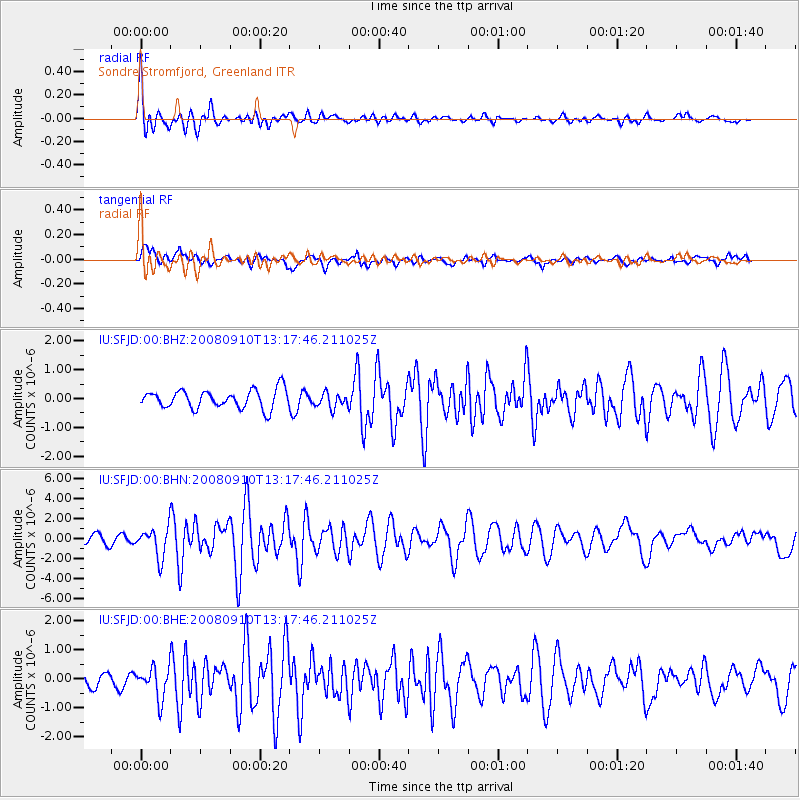
Signal To Noise
| Channel | StoN | STA | LTA |
| IU:SFJD:00:BHN:20080910T13:17:46.211025Z | 4.54313 | 1.50696E-6 | 3.3170082E-7 |
| IU:SFJD:00:BHE:20080910T13:17:46.211025Z | 2.2557507 | 5.373336E-7 | 2.3820613E-7 |
| IU:SFJD:00:BHZ:20080910T13:17:46.211025Z | 0.8116645 | 2.5823056E-7 | 3.1814935E-7 |
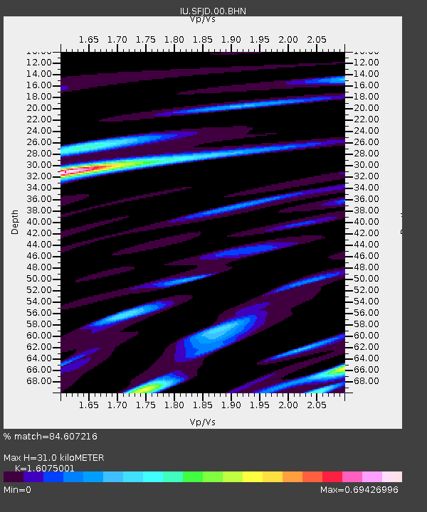
| Arrivals | |
| Ps | 3.1 SECOND |
| PpPs | 12 SECOND |
| PsPs/PpSs | 15 SECOND |

