
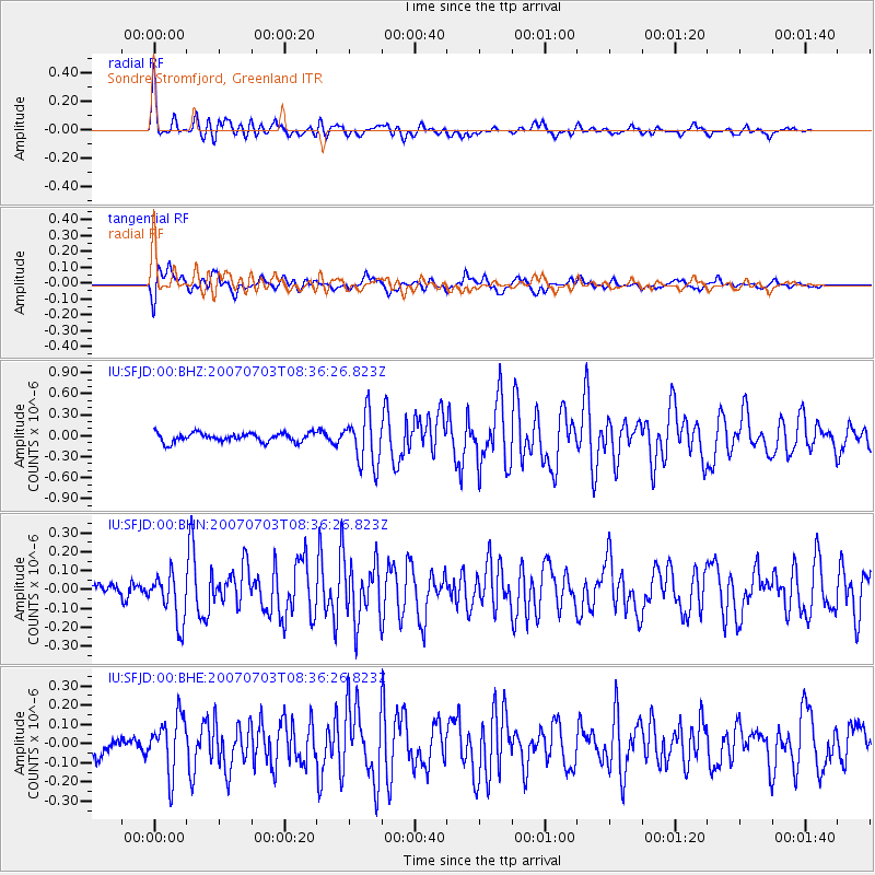
SFJD Sondre Stromfjord, Greenland - Earthquake Result Viewer
| ||||||||||||||||||
| ||||||||||||||||||
| ||||||||||||||||||
|
Signal To Noise
| Channel | StoN | STA | LTA |
| IU:SFJD:00:BHN:20070703T08:36:26.823Z | 3.3754592 | 1.2671147E-7 | 3.753903E-8 |
| IU:SFJD:00:BHE:20070703T08:36:26.823Z | 2.7168977 | 1.449077E-7 | 5.333572E-8 |
| IU:SFJD:00:BHZ:20070703T08:36:26.823Z | 5.581757 | 3.6112232E-7 | 6.469689E-8 |
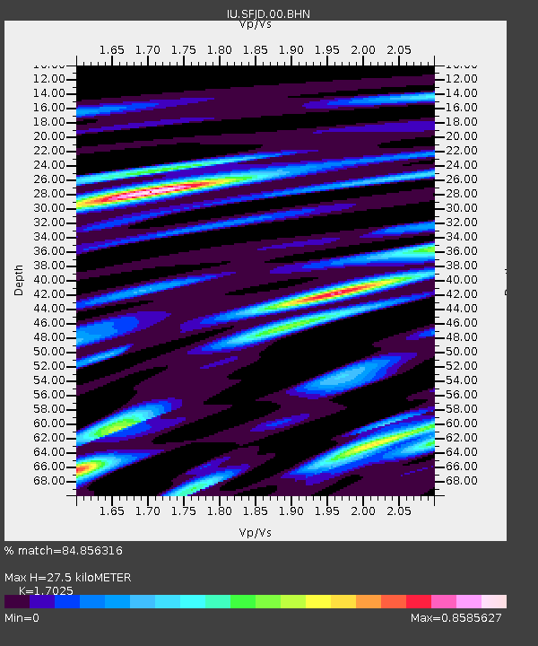
| Arrivals | |
| Ps | 3.1 SECOND |
| PpPs | 11 SECOND |
| PsPs/PpSs | 14 SECOND |

