You are here: Home > Network List > TA - USArray Transportable Network (new EarthScope stations) Stations List
> Station H17A Grant Village (NPS), Yellowstone Nt. Park, WY, USA > Earthquake Result Viewer
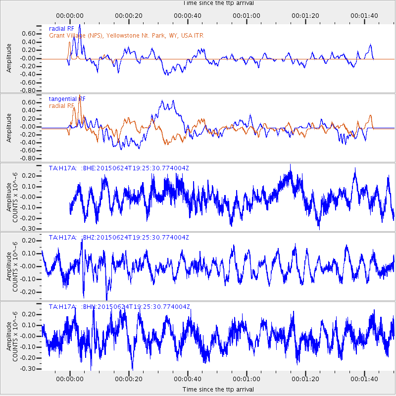
H17A Grant Village (NPS), Yellowstone Nt. Park, WY, USA - Earthquake Result Viewer
*The percent match for this event was below the threshold and hence no stack was calculated.
| Earthquake location: |
Southern Xinjiang, China |
| Earthquake latitude/longitude: |
41.8/88.4 |
| Earthquake time(UTC): |
2015/06/24 (175) 19:12:53 GMT |
| Earthquake Depth: |
29 km |
| Earthquake Magnitude: |
5.1 MW, 5.3 mb, 4.6 MS |
| Earthquake Catalog/Contributor: |
ISC/ISC |
|
| Network: |
TA USArray Transportable Network (new EarthScope stations) |
| Station: |
H17A Grant Village (NPS), Yellowstone Nt. Park, WY, USA |
| Lat/Lon: |
44.40 N/110.58 W |
| Elevation: |
2400 m |
|
| Distance: |
92.5 deg |
| Az: |
13.464 deg |
| Baz: |
345.951 deg |
| Ray Param: |
$rayparam |
*The percent match for this event was below the threshold and hence was not used in the summary stack. |
|
| Radial Match: |
58.172005 % |
| Radial Bump: |
400 |
| Transverse Match: |
44.556976 % |
| Transverse Bump: |
400 |
| SOD ConfigId: |
7422571 |
| Insert Time: |
2019-04-19 11:09:24.013 +0000 |
| GWidth: |
2.5 |
| Max Bumps: |
400 |
| Tol: |
0.001 |
|
Signal To Noise
| Channel | StoN | STA | LTA |
| TA:H17A: :BHZ:20150624T19:25:30.774004Z | 1.6196141 | 8.788857E-8 | 5.4265133E-8 |
| TA:H17A: :BHN:20150624T19:25:30.774004Z | 1.2325302 | 1.15126625E-7 | 9.340673E-8 |
| TA:H17A: :BHE:20150624T19:25:30.774004Z | 0.9266414 | 8.417854E-8 | 9.084262E-8 |
| Arrivals |
| Ps | |
| PpPs | |
| PsPs/PpSs | |


