You are here: Home > Network List > UW - Pacific Northwest Regional Seismic Network Stations List
> Station HOOD Mt Hood Meadows, OR CREST BB SMO > Earthquake Result Viewer
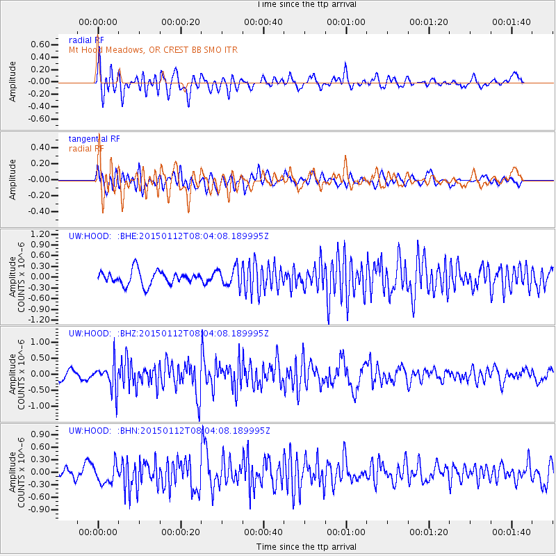
HOOD Mt Hood Meadows, OR CREST BB SMO - Earthquake Result Viewer
*The percent match for this event was below the threshold and hence no stack was calculated.
| Earthquake location: |
Near Coast Of Chiapas, Mexico |
| Earthquake latitude/longitude: |
15.5/-93.4 |
| Earthquake time(UTC): |
2015/01/12 (012) 07:57:27 GMT |
| Earthquake Depth: |
75 km |
| Earthquake Magnitude: |
5.5 MWW, 5.5 MWC, 5.5 MWB |
| Earthquake Catalog/Contributor: |
NEIC PDE/NEIC COMCAT |
|
| Network: |
UW Pacific Northwest Regional Seismic Network |
| Station: |
HOOD Mt Hood Meadows, OR CREST BB SMO |
| Lat/Lon: |
45.32 N/121.65 W |
| Elevation: |
1520 m |
|
| Distance: |
38.1 deg |
| Az: |
327.2 deg |
| Baz: |
132.241 deg |
| Ray Param: |
$rayparam |
*The percent match for this event was below the threshold and hence was not used in the summary stack. |
|
| Radial Match: |
67.81543 % |
| Radial Bump: |
400 |
| Transverse Match: |
60.360607 % |
| Transverse Bump: |
400 |
| SOD ConfigId: |
872571 |
| Insert Time: |
2015-02-19 09:16:10.800 +0000 |
| GWidth: |
2.5 |
| Max Bumps: |
400 |
| Tol: |
0.001 |
|
Signal To Noise
| Channel | StoN | STA | LTA |
| UW:HOOD: :BHZ:20150112T08:04:08.189995Z | 3.0900059 | 4.3445812E-7 | 1.4060107E-7 |
| UW:HOOD: :BHN:20150112T08:04:08.189995Z | 1.676954 | 2.4388234E-7 | 1.4543174E-7 |
| UW:HOOD: :BHE:20150112T08:04:08.189995Z | 1.370072 | 2.6230873E-7 | 1.9145617E-7 |
| Arrivals |
| Ps | |
| PpPs | |
| PsPs/PpSs | |


